
3 Hour Run at Mendon Ponds
Monday, July 31, 2006
The heat and humidity smothering the northeast makes it very difficult to do long runs. I was originally planning to run 16 miles or so along the Genesee Valley Greenway; unfortunately, that's mostly in the sun, and I knew I couldn't handle four hours of running in the sun in this heat. So instead I headed over to Mendon Ponds for a shorter, mostly shady but much more hilly route.
I warmed up by running the trails through the woods from the beach lot and then over along the shore of Deep Pond. Hit some very wet sections - bright green frogs bouncing every which way as I made my way through. From there I headed up into the hills in the eastern section (where I ran the Powerbar Trail Race back in June.) All too soon I was out of the shade and in the eastern meadows, but then did a loop in a pine forest along the northeastern boundary of the park. That was a nice relaxing gentle downhill, until I hit the second half of the loop and discovered that what goes down must also go up... and up... and up... From there it was back into the meadows until I hit the dirt road to the water tower, at just under two hours. At that point I headed back to the car to grab more fluids, and after a very brief break headed back into the shaded hills of the east esker trails. Lots of up and down, some of it very steep... and lots of walking. The heat was really taking its toll, especially when I hit the open fields... ouch. But after another hour, I finally plodded back to the car, and headed back to Rochester to pick Ann up at work. (I'd given her a ride in that morning, so she wouldn't need to ride her bike in the heat.)
Some of the trails that I hadn't been on before looked vaguely familiar, so I checked out the Western NY Ultra Series photos of the course for the Mendon 50K and sure enough, that's part of where I was today (unfortunately, the toughest, hilliest part!) That does not bode well for how long it will take me to finish the 50K... assuming I remain in sufficiently good health to attempt it in November.
JMH
Sunday, July 30, 2006
LUNCHTIME FOR EGRETS
Riding Along the Genesee Riverway Trail
Sunday, July 30, 2006
Ann and I headed off for an easy ride today - down the canal path to Genesee Valley Park, along the west side of the river, and then back up the east side - at first it wasn't clear to me why she wanted to head toward the city, but when the trail was blocked by construction she admitted she'd been hoping to go to lunch at the Dinosaur Bar-B-Que. While that plan was squashed, we did get to see a white egret up fairly close. He was in the grass at one of the waterfront parks, clearly stalking something, then - BANG - his head darted out and he caught his prey. After watching him for a few minutes (and observing a couple of missed attempts) it became clear he was hunting grasshoppers!
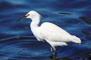
Not the egret we saw, but it sure looks like him...
Too bad for the grasshoppers, but a very cool sight to see!
JMH
Riding Along the Genesee Riverway Trail
Sunday, July 30, 2006
Ann and I headed off for an easy ride today - down the canal path to Genesee Valley Park, along the west side of the river, and then back up the east side - at first it wasn't clear to me why she wanted to head toward the city, but when the trail was blocked by construction she admitted she'd been hoping to go to lunch at the Dinosaur Bar-B-Que. While that plan was squashed, we did get to see a white egret up fairly close. He was in the grass at one of the waterfront parks, clearly stalking something, then - BANG - his head darted out and he caught his prey. After watching him for a few minutes (and observing a couple of missed attempts) it became clear he was hunting grasshoppers!
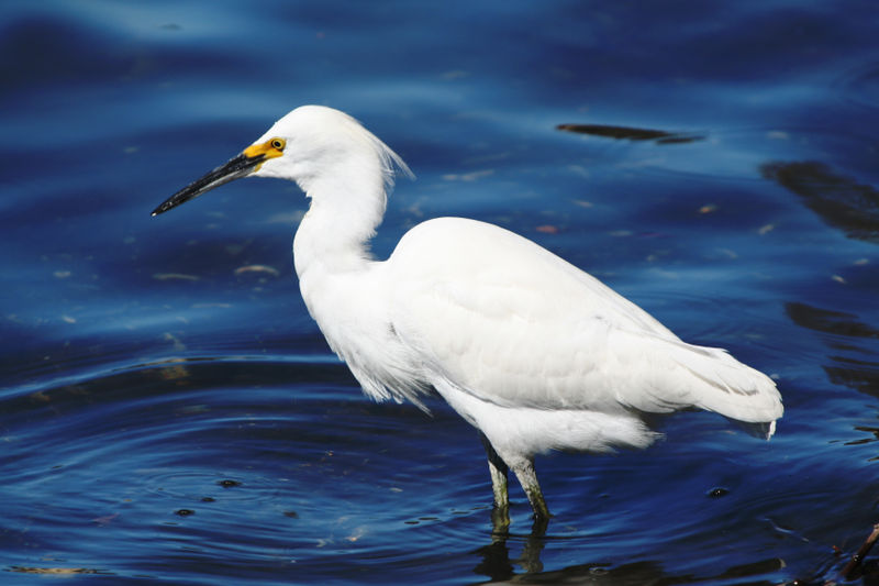
Not the egret we saw, but it sure looks like him...
Too bad for the grasshoppers, but a very cool sight to see!
JMH

Saturday, July 29, 2006
A Year of Long Distance - Race#9
Forge the Gorgeous 7 Mi Trail Race
Saturday, July 29, 2006
2006 Forge the Gorgeous results
Forge the Gorgeous trail race info
2006 Forge the Gorgeous trail race photo slideshow
info about Fillmore Glen and the waterfalls
Well, THAT was a bear!
It’s been long enough since I did a race where I needed to leave at an ungodly hour that it took a major effort to get up at 3:15 AM (so I could be at Fillmore Glen State Park by a little after 8 AM.) But I dragged my lazy backside out of bed, packed everything in the car, and hit the road a bit before 5 AM… fun, fun, fun!
As usual, one plus to driving early in the morning – little to no traffic! Lots of mist and fog and welcome cool air – a nice change from the weather we’ve been having lately. Made it to Syracuse and then headed off to parts unknown down I81. That was a bit of a surprise – I’m so used to western NY being mostly flat that the hills of Syracuse seemed to go up and up and up! And then, after leaving I81, I spent 10 miles driving through what must have been the yard sale capital of NYS – I think I passed two dozen yard sales (and spent much of the time dodging cars parked alongside the road!)
After arriving at the park I checked in (and got a nice welcome from the folks behind the table for having come all the way from Albany) and then got changed for the race. After that I spent a while wandering to see the sights – a replica of the log cabin where Millard Fillmore (13th president) was born (a few miles from the park); water running across the road below a small dam (that came in handy after the race!); and a fairly impressive waterfall a little ways upstream. I also looked up the long flight of stairs leading up to one of the trails we’d be running and realized what the race app meant by “one long hill near the start”…
A little before 9 AM we all trooped down to the start near the park entrance, and it became clear this would be one of the smallest races I’ve been in – about 50 runners total! The start was quite scenic, taking us through a double row of trees up into the park. The RD said a few words about the course, we waited while one last runner ran down from the registration area – and then off we went!


The first bit was deceptively easy – across the grass and onto a trail behind the picnic shelter and swimming area. Then the “fun” began – a ½ mile climb to the top of the gorge, along the North Rim trail. I had flashbacks to the Greylock Death March as I trudged up the hill… except I knew this wouldn’t last nearly as long as that did! Eventually the trail leveled off, we crossed the dam at the top of the gorge, and headed down the South Rim trail – a welcome change from the previous uphill climbs. That ended all too quickly, but then we hit the best part of the whole race – running up the gorge trail. Fillmore Glen is basically a mini-Watkins Glen – the creek running down through the gorge drops over several larger waterfalls and a number of small cascades, and the trails winds back and forth across the creek on eight bridges. The whole trail was absolutely awesome – cool and shady, relatively level (except for the occasional set of steps and the slippery wooden bridges, and with spectacular waterfalls. (And unfortunately my disposable camera ran out of film before I got to the best set of waterfalls – including a spray running down the side of the gorge that we got to run through!) After that it was another steep path back to the rim, then we retraced out path back to the dam at the top of the gorge and ran back down the North Rim trail. The downhill stretch at the end was actually easier than I’d expected (downhills are where I’m most likely to blow out a knee, so I have to take it pretty easy on them… steep downhills can slow me to a crawl.) The final run to the finish was over level ground, and I had some nice folks cheering me on at the end, where I got my “Finger Lakes Running Club” finisher’s pin – kind of cool, actually, to get something like that at such a small race.


Afterwards, I grabbed a bagel and cream cheese, headed over to the spot where the road ran though the creek, and sat down on a rock with my feet in the wonderfully cold water. (Not quite as blissful as sitting on the front of my car eating soup and a bagel after last November’s Lil’ Rhody Runaround, but close!) My feet cooled down pretty quickly, and I briefly contemplated sitting in the water to cool my legs – but then decided that driving two hours to Rochester in wet shorts wouldn’t be pleasant. So instead I settled for splashing water on my legs before heading to the car to change into dry clothes.
Forge the Gorgeous 7 Mi Trail Race
Saturday, July 29, 2006
2006 Forge the Gorgeous results
Forge the Gorgeous trail race info
2006 Forge the Gorgeous trail race photo slideshow
info about Fillmore Glen and the waterfalls
Well, THAT was a bear!
It’s been long enough since I did a race where I needed to leave at an ungodly hour that it took a major effort to get up at 3:15 AM (so I could be at Fillmore Glen State Park by a little after 8 AM.) But I dragged my lazy backside out of bed, packed everything in the car, and hit the road a bit before 5 AM… fun, fun, fun!
As usual, one plus to driving early in the morning – little to no traffic! Lots of mist and fog and welcome cool air – a nice change from the weather we’ve been having lately. Made it to Syracuse and then headed off to parts unknown down I81. That was a bit of a surprise – I’m so used to western NY being mostly flat that the hills of Syracuse seemed to go up and up and up! And then, after leaving I81, I spent 10 miles driving through what must have been the yard sale capital of NYS – I think I passed two dozen yard sales (and spent much of the time dodging cars parked alongside the road!)
After arriving at the park I checked in (and got a nice welcome from the folks behind the table for having come all the way from Albany) and then got changed for the race. After that I spent a while wandering to see the sights – a replica of the log cabin where Millard Fillmore (13th president) was born (a few miles from the park); water running across the road below a small dam (that came in handy after the race!); and a fairly impressive waterfall a little ways upstream. I also looked up the long flight of stairs leading up to one of the trails we’d be running and realized what the race app meant by “one long hill near the start”…
A little before 9 AM we all trooped down to the start near the park entrance, and it became clear this would be one of the smallest races I’ve been in – about 50 runners total! The start was quite scenic, taking us through a double row of trees up into the park. The RD said a few words about the course, we waited while one last runner ran down from the registration area – and then off we went!


The first bit was deceptively easy – across the grass and onto a trail behind the picnic shelter and swimming area. Then the “fun” began – a ½ mile climb to the top of the gorge, along the North Rim trail. I had flashbacks to the Greylock Death March as I trudged up the hill… except I knew this wouldn’t last nearly as long as that did! Eventually the trail leveled off, we crossed the dam at the top of the gorge, and headed down the South Rim trail – a welcome change from the previous uphill climbs. That ended all too quickly, but then we hit the best part of the whole race – running up the gorge trail. Fillmore Glen is basically a mini-Watkins Glen – the creek running down through the gorge drops over several larger waterfalls and a number of small cascades, and the trails winds back and forth across the creek on eight bridges. The whole trail was absolutely awesome – cool and shady, relatively level (except for the occasional set of steps and the slippery wooden bridges, and with spectacular waterfalls. (And unfortunately my disposable camera ran out of film before I got to the best set of waterfalls – including a spray running down the side of the gorge that we got to run through!) After that it was another steep path back to the rim, then we retraced out path back to the dam at the top of the gorge and ran back down the North Rim trail. The downhill stretch at the end was actually easier than I’d expected (downhills are where I’m most likely to blow out a knee, so I have to take it pretty easy on them… steep downhills can slow me to a crawl.) The final run to the finish was over level ground, and I had some nice folks cheering me on at the end, where I got my “Finger Lakes Running Club” finisher’s pin – kind of cool, actually, to get something like that at such a small race.


Afterwards, I grabbed a bagel and cream cheese, headed over to the spot where the road ran though the creek, and sat down on a rock with my feet in the wonderfully cold water. (Not quite as blissful as sitting on the front of my car eating soup and a bagel after last November’s Lil’ Rhody Runaround, but close!) My feet cooled down pretty quickly, and I briefly contemplated sitting in the water to cool my legs – but then decided that driving two hours to Rochester in wet shorts wouldn’t be pleasant. So instead I settled for splashing water on my legs before heading to the car to change into dry clothes.


There were two things that made this a bear – the terrain (some of the hills were definitely tough!!!) and the humidity (despite running virtually the whole thing on shaded trails, it was hotter than heck.) As a result, my time was fairly pathetic – 1:38:40 for 7 miles, or slightly over 14 minutes per mile. But the scenery was great, and the people there seemed like a really nice group. I’d definitely like to do some more the the FLRC races (the 25K back on July 1 was one of theirs – too bad I missed it!) and I think I’d like to do this one again (if for no other reason than to see if I can go a little faster!)

Next up: The Race the Train 8.4 mile run from Riparius to North Creek (for some reason I think the train’s going to win… but it’s different enough that I thought it would be fun to do, at least once…)
JMH
2006 event totals
snowshoe - 3 miles, 59.5 min
running - 90.8 miles, 23 hr 20 min
riding - 32.4 miles, 2 hr 32 min
Wednesday, July 26, 2006
3 1/2 Hour Run in the Wilds of Thacher State Park
Wednesday, July 26, 2006
Several days later than I intended, and at Thacher rather than October Mountain State Forest in MA, and not as long (distance-wise) as I'd hoped to do - but I finally got off my backside and ran my long run for the week.
My plan was to run the escarpment up to the OSI/Thacher property, then run the Long Path out to the old quarry, then head back and loop through the Paint Mine/Hop Field trails to finish out at about 15-16 miles. As usual, things didn't go quite as I'd planned...
The run along the escarpment and up into the OSI/Thacher property went as expected - I've run both many times before, since the latter part is a section of the second loop of the Indian Ladder trail run (in other words, I ran it a little over a week ago in the race!) Hit the gravel road - and lost the Long Path. So I made my way along the gravel/stone roads we used last year in the Hairy Gorilla Half Marathon and ended up at the old quarry. From there it was easy to find the Long Path again... running that section was another story! After a good start I ended up first heading through a meadow with waist-high grass and uneven footing (ie walk or blow out a knee.) Then the trail headed into the woods and became a "true" hiking trail - barely discernable singletrack (thank heavens for blazes!) with mostly uneven footing (again, lots more walking.)
I made it back to the Indian Ladder area about 3 1/4 hours into the run, and realized I just didn't have the time to loop up into the woods (I needed to be over at the karate school later in the evening to teach class.) So I returned along the escarpment and did the final bit along the road, wrapping up at 3 1/2 hours and probably about 12.5 miles. Tired but not thrashed, which I take as a decent sign for both the Savoy 20 mile trail race in a few weeks and the Adirondack marathon in 1 1/2 months. Still have a bunch of training to do, but it looks doable.
JMH
Wednesday, July 26, 2006
Several days later than I intended, and at Thacher rather than October Mountain State Forest in MA, and not as long (distance-wise) as I'd hoped to do - but I finally got off my backside and ran my long run for the week.
My plan was to run the escarpment up to the OSI/Thacher property, then run the Long Path out to the old quarry, then head back and loop through the Paint Mine/Hop Field trails to finish out at about 15-16 miles. As usual, things didn't go quite as I'd planned...
The run along the escarpment and up into the OSI/Thacher property went as expected - I've run both many times before, since the latter part is a section of the second loop of the Indian Ladder trail run (in other words, I ran it a little over a week ago in the race!) Hit the gravel road - and lost the Long Path. So I made my way along the gravel/stone roads we used last year in the Hairy Gorilla Half Marathon and ended up at the old quarry. From there it was easy to find the Long Path again... running that section was another story! After a good start I ended up first heading through a meadow with waist-high grass and uneven footing (ie walk or blow out a knee.) Then the trail headed into the woods and became a "true" hiking trail - barely discernable singletrack (thank heavens for blazes!) with mostly uneven footing (again, lots more walking.)
I made it back to the Indian Ladder area about 3 1/4 hours into the run, and realized I just didn't have the time to loop up into the woods (I needed to be over at the karate school later in the evening to teach class.) So I returned along the escarpment and did the final bit along the road, wrapping up at 3 1/2 hours and probably about 12.5 miles. Tired but not thrashed, which I take as a decent sign for both the Savoy 20 mile trail race in a few weeks and the Adirondack marathon in 1 1/2 months. Still have a bunch of training to do, but it looks doable.
JMH
Monday, July 24, 2006
12 Mile Run Along the Mohawk-Hudson Bikepath
Sunday, July 23, 2006
The original plan was to go to Massachusetts and run 15-16 miles at the October Mountain State Forest. But I've been feeling tired this weekend, and the thought of the 2+ hour round trip drive (in addition to the 3-4 hour run!) was just too much. So instead I headed over to the bike path west of Schenectady and shortened the run a bit (I need to work on building up distance on pavement, given how little pavement running I've been doing during the past few years.)
The cold front which moved through earlier in the weekend brought some rain but also cooled things down a bit and most especially cut the humidity (one of the reasons I'd plannned to do a long run this weekend!) It was great weather for running in July - sunny and definitely warm, but not horribly so. Not a lot of traffic on the bike path either, which was nice. I started at Lock 8 and ran along the river to the park in Rotterdam, then continued along the Old Erie Canal until the end of the path at Scrafford Lane. When I got back to the Lock, I decided to extend the run a bit (I'd gone about 9.5 miles) so I ran somewhat over another mile out and back in the other direction, for a total of about 12 miles in 2 hrs 20 minutes. I was particularly pleased with my time - I wasn't pushing super hard but still managed a decent pace, which bodes well for the Adirondack Marathon (assuming my knees and legs hold up for 26 miles of road running...)
JMH
Sunday, July 23, 2006
The original plan was to go to Massachusetts and run 15-16 miles at the October Mountain State Forest. But I've been feeling tired this weekend, and the thought of the 2+ hour round trip drive (in addition to the 3-4 hour run!) was just too much. So instead I headed over to the bike path west of Schenectady and shortened the run a bit (I need to work on building up distance on pavement, given how little pavement running I've been doing during the past few years.)
The cold front which moved through earlier in the weekend brought some rain but also cooled things down a bit and most especially cut the humidity (one of the reasons I'd plannned to do a long run this weekend!) It was great weather for running in July - sunny and definitely warm, but not horribly so. Not a lot of traffic on the bike path either, which was nice. I started at Lock 8 and ran along the river to the park in Rotterdam, then continued along the Old Erie Canal until the end of the path at Scrafford Lane. When I got back to the Lock, I decided to extend the run a bit (I'd gone about 9.5 miles) so I ran somewhat over another mile out and back in the other direction, for a total of about 12 miles in 2 hrs 20 minutes. I was particularly pleased with my time - I wasn't pushing super hard but still managed a decent pace, which bodes well for the Adirondack Marathon (assuming my knees and legs hold up for 26 miles of road running...)
JMH
Saturday, July 22, 2006
Monday, July 17, 2006
A Year of Long Distance - Race#8
Indian Ladder 15K Trail Race
Sunday, July 16, 2006
2006 Indian Ladder 15K Trail Race results
photo slideshow of 2006 ILTR 15K Trail Race
For much of the past year I didn't think I was going to run Indian Ladder this year. After all, I've run it 7 times in the past 9 years, and this would be the 5th year for me to run the current course. The race and the course just didn't seem that exciting anymore. But then as the 2006 running season progressed I found myself wanting more and more to do the race. Not because it's exciting - but because it's an old friend. OK, and because I was hoping I might run it a little bit faster than last year! (I didn't, by the way...)
After weeks of chilly, rainy weather - the weeks leading up to Indian Ladder were the hottest we've had this year, and the day itself was a scorcher. Aggravating to run in, but good practice for August, I guess. At least we had a bright, sunny day!


One change this year - the course was the muddiest I've ever seen it (since they changed the course and cut out the section through the Hop Field swamps.) Apparently this led to a lot of slips and falls, including one fellow who either dislocated or broke his shoulder. I did a little slipping a sliding, but it wasn't too bad - with all the rain we've had I've gotten somewhat used to sloshing through muck on my runs. I did fall once, early on (tripped on a rock! Gah!) and slipped a bit coming down a steep bank late in the race (tweaking both knees, which have already been complaining from being wrenched during the Plotter Kill run earlier this week! Gah!) but no big deal.

You would think by now I'd know how to run this race - seems like every year I go out too fast and then die in the 2nd half. This year was no exception - I hit the 4 mile mark averaging just over 10 minute miles, and then took over an hour to run the next 5 miles. I think part of the problem is I always seem to forget how tough the terrain is in the 2nd half - mostly singletrack, with lots of up and down and semi-technical terrain (the type where it's really easy to blow out a knee, if you have knees like mine!) Ran parts of the 1st half with some newbies, and once again came away feeling like a grizzled old Trail Turtle... it's always strange when other runners look to me for support and reassurance, given that I'm really not very good at this running thing! (Then again, I guess in this particular race I do have the advantage of experience, having run this course 5 times in 6 years.)

So I ran the race, and had a certain amount of self-torturous fun, and abandoned my partial plan to run the 3.5 miler (it was just too freakin' hot... my legs could have handled it but the rest of me would have gone into meltdown.) Right now I seem stuck in the high 1:40's finishing time - last year was 1:48, this year 1:49 - so I guess I'll have no choice but to run Indian Ladder again next year to see if (1) I can finish this race faster, and (2) I can finally run both the long and the short races.

And as always, Ann was a good sport about being there and taking care of me afterwards. I'm lucky she puts up with me.
Next up: the Forge the Gorgeous 7 mile Trail Race at Filmore Glen State Park! (Assuming I can get my backside out of bed in time to get there Saturday morning!)
JMH
2006 event totals
snowshoe - 3 miles, 59.5 min
running - 83.8 miles, 21 hr 40 min
riding - 32.4 miles, 2 hr 32 min
Indian Ladder 15K Trail Race
Sunday, July 16, 2006
2006 Indian Ladder 15K Trail Race results
photo slideshow of 2006 ILTR 15K Trail Race
For much of the past year I didn't think I was going to run Indian Ladder this year. After all, I've run it 7 times in the past 9 years, and this would be the 5th year for me to run the current course. The race and the course just didn't seem that exciting anymore. But then as the 2006 running season progressed I found myself wanting more and more to do the race. Not because it's exciting - but because it's an old friend. OK, and because I was hoping I might run it a little bit faster than last year! (I didn't, by the way...)
After weeks of chilly, rainy weather - the weeks leading up to Indian Ladder were the hottest we've had this year, and the day itself was a scorcher. Aggravating to run in, but good practice for August, I guess. At least we had a bright, sunny day!


One change this year - the course was the muddiest I've ever seen it (since they changed the course and cut out the section through the Hop Field swamps.) Apparently this led to a lot of slips and falls, including one fellow who either dislocated or broke his shoulder. I did a little slipping a sliding, but it wasn't too bad - with all the rain we've had I've gotten somewhat used to sloshing through muck on my runs. I did fall once, early on (tripped on a rock! Gah!) and slipped a bit coming down a steep bank late in the race (tweaking both knees, which have already been complaining from being wrenched during the Plotter Kill run earlier this week! Gah!) but no big deal.

You would think by now I'd know how to run this race - seems like every year I go out too fast and then die in the 2nd half. This year was no exception - I hit the 4 mile mark averaging just over 10 minute miles, and then took over an hour to run the next 5 miles. I think part of the problem is I always seem to forget how tough the terrain is in the 2nd half - mostly singletrack, with lots of up and down and semi-technical terrain (the type where it's really easy to blow out a knee, if you have knees like mine!) Ran parts of the 1st half with some newbies, and once again came away feeling like a grizzled old Trail Turtle... it's always strange when other runners look to me for support and reassurance, given that I'm really not very good at this running thing! (Then again, I guess in this particular race I do have the advantage of experience, having run this course 5 times in 6 years.)

So I ran the race, and had a certain amount of self-torturous fun, and abandoned my partial plan to run the 3.5 miler (it was just too freakin' hot... my legs could have handled it but the rest of me would have gone into meltdown.) Right now I seem stuck in the high 1:40's finishing time - last year was 1:48, this year 1:49 - so I guess I'll have no choice but to run Indian Ladder again next year to see if (1) I can finish this race faster, and (2) I can finally run both the long and the short races.

And as always, Ann was a good sport about being there and taking care of me afterwards. I'm lucky she puts up with me.
Next up: the Forge the Gorgeous 7 mile Trail Race at Filmore Glen State Park! (Assuming I can get my backside out of bed in time to get there Saturday morning!)
JMH
2006 event totals
snowshoe - 3 miles, 59.5 min
running - 83.8 miles, 21 hr 40 min
riding - 32.4 miles, 2 hr 32 min
Sunday, July 16, 2006
MARTIAL ARTS AND SOME PRETTY COOL HIKING
Grand Opening Demonstrations at the New AMAI Utica Location
Hiking at Moss Island, Wintergreen Park, and Five Rivers Environmental Education Center
Saturday, July 15, 2006
more info about Little Falls & Moss Island
more info about Wintergreen Park and Canajoharie Falls
Moss Island photo slideshow
Definitely a long day. A little after 6 AM we hit the road in Rochester.
1st stop - the new Utica location for AMAI (actually, it's in New Hartford, just west of Utica.) After a brief instructional staff meeting, the Grand Opening celebrations started. All day long instructors would be performing katas, breaks, meditation demonstrations, and self-defense demonstrations. In addition, the iaido students did a brief demonstration. Ann and I had to leave not long after that, so we missed most of the day's events (I would have liked to see the cane and escrima demos, but so it goes.)


After that we stopped at Moss Island in Little Falls. Walked across a HUGE lock on the barge canal and then explored the park a bit. Got to see some very cool rock formations and read about how the whole area was once an enormous waterfall (which is what gouged out the cool rock formations.) I hope to go back someday and explore a bit more. but I think we saw a lot of the best parts of the park.


From there we went to Canajoharie and eventually found Wintergreen Park, along the Canajoharie gorge. Hiked the footpath down to the Canajoharie Falls viewpoint - kind of neat, but nothing spectacular. I suspect the view from the creek bed is probably much more interesting, but the many signs in the park made it clear that creek walking is not permitted. I'd also been hoping to see the Boiling Pot, a large circular hole in the rock creekbed, but didn't have directions to it (I've since found out we needed to park in town and walk upstream a ways to see that. Oh, well.)
Once we got back to Albany we headed to Five Rivers to walk along the peaceful Vloman Kill for a bit, then headed down to the two beaver ponds. Saw a couple of big snapping turtles and lots of red-eared sliders swimming around. It was very buggy but lots of fun all the same.
JMH
Grand Opening Demonstrations at the New AMAI Utica Location
Hiking at Moss Island, Wintergreen Park, and Five Rivers Environmental Education Center
Saturday, July 15, 2006
more info about Little Falls & Moss Island
more info about Wintergreen Park and Canajoharie Falls
Moss Island photo slideshow
Definitely a long day. A little after 6 AM we hit the road in Rochester.
1st stop - the new Utica location for AMAI (actually, it's in New Hartford, just west of Utica.) After a brief instructional staff meeting, the Grand Opening celebrations started. All day long instructors would be performing katas, breaks, meditation demonstrations, and self-defense demonstrations. In addition, the iaido students did a brief demonstration. Ann and I had to leave not long after that, so we missed most of the day's events (I would have liked to see the cane and escrima demos, but so it goes.)


After that we stopped at Moss Island in Little Falls. Walked across a HUGE lock on the barge canal and then explored the park a bit. Got to see some very cool rock formations and read about how the whole area was once an enormous waterfall (which is what gouged out the cool rock formations.) I hope to go back someday and explore a bit more. but I think we saw a lot of the best parts of the park.


From there we went to Canajoharie and eventually found Wintergreen Park, along the Canajoharie gorge. Hiked the footpath down to the Canajoharie Falls viewpoint - kind of neat, but nothing spectacular. I suspect the view from the creek bed is probably much more interesting, but the many signs in the park made it clear that creek walking is not permitted. I'd also been hoping to see the Boiling Pot, a large circular hole in the rock creekbed, but didn't have directions to it (I've since found out we needed to park in town and walk upstream a ways to see that. Oh, well.)
Once we got back to Albany we headed to Five Rivers to walk along the peaceful Vloman Kill for a bit, then headed down to the two beaver ponds. Saw a couple of big snapping turtles and lots of red-eared sliders swimming around. It was very buggy but lots of fun all the same.
JMH
Wednesday, July 12, 2006
Return to the Plotter Kill Preserve
Tuesday, July 11, 2006
some info on the Plotter Kill Preserve
map of the Plotter Kill Preserve
Back in March I ran for the first time at the Plotter Kill Preserve in Rotterdam, and found it very challenging. In my opinion, the trails there are the closest to gnarly Berkshire trails in the Albany area (though there are some at Thacher which come close...) and the initial sections involve some very steep climbs up and down. So there was no doubt in my mind that I had to go back this summer!
I headed into the preserve and started out on a trail I'd never taken before - the ominously named "Highland Trail" (!) My initial impression was flashbacks to the Greylock Death March, since the first 3/4 of a mile was pretty much non-stop climbing. Plotter Kill distinguished itself from Greylock, though, due to the fact that much of the trail was either deep mud or under water (I've never seen so many frogs jumping out of my way during a run!) Apparently it also doesn't see much use - many sections were fairly overgrown. But after a while it leveled off and I had a comfortable run through the woods to the edge of the ravine leading to the third waterfall.
The climb down into the ravine and up the other side was one of the more challenging parts of the run. But the trail along the northern side of the gorge levels off after that, and the running was good! Of course, all too quickly (OK, half an houror so later) I was carefully picking my way down to and across the creek, and then back up the other side - and the 3/4 mile climb to the south rim. While I did better at that than back in March, I still walked a good deal of the way up, and then spent a while recovering... but before too long the running was good again, with some great views down the power line right-of-ways (maybe that makes up for the ankle-deep mud at those right-of-ways...) Then it was time to descend to the creek again, and I decided to once again try a trail I was unfamiliar with. THAT was a mistake... I ended up picking my way along a slippery, rocky "trail" along the creek and wrenched both knees twice when I slipped and fell.
Once I finally made my way back to the north rim, I decided to only do one loop, and headed back out on the trail I'd run on the way in. Passed two hikers who commented both on the amount of water I was carrying and the fact that I seemed to be outrunning the 'skeeters (they caught up with me whenever I stopped to walk, unfortunately) and once again hiked down into the ravine and up the other side. When I had almost reached the parking lot, I decided I didn't want to end the evening just yet, so I ran a short loop along the south rim back to the parking lot.
Took 2 1/2 hours this time (as opposed to 3 back in March) though I also ran a bit further (probably an extra mile or so.) Not a phenomenal improvement - but I did run a lot more than previously, and was still feeling pretty good at the end of the day. I don't think I want to run there every week - it's a bit of a haul to get there, and there aren't many trails to choose from - but I definitely want to come back again.
(And maybe some day I can go there after a heavy rainfall and see the waterfalls in all their glory!)
JMH
Tuesday, July 11, 2006
some info on the Plotter Kill Preserve
map of the Plotter Kill Preserve
Back in March I ran for the first time at the Plotter Kill Preserve in Rotterdam, and found it very challenging. In my opinion, the trails there are the closest to gnarly Berkshire trails in the Albany area (though there are some at Thacher which come close...) and the initial sections involve some very steep climbs up and down. So there was no doubt in my mind that I had to go back this summer!
I headed into the preserve and started out on a trail I'd never taken before - the ominously named "Highland Trail" (!) My initial impression was flashbacks to the Greylock Death March, since the first 3/4 of a mile was pretty much non-stop climbing. Plotter Kill distinguished itself from Greylock, though, due to the fact that much of the trail was either deep mud or under water (I've never seen so many frogs jumping out of my way during a run!) Apparently it also doesn't see much use - many sections were fairly overgrown. But after a while it leveled off and I had a comfortable run through the woods to the edge of the ravine leading to the third waterfall.
The climb down into the ravine and up the other side was one of the more challenging parts of the run. But the trail along the northern side of the gorge levels off after that, and the running was good! Of course, all too quickly (OK, half an houror so later) I was carefully picking my way down to and across the creek, and then back up the other side - and the 3/4 mile climb to the south rim. While I did better at that than back in March, I still walked a good deal of the way up, and then spent a while recovering... but before too long the running was good again, with some great views down the power line right-of-ways (maybe that makes up for the ankle-deep mud at those right-of-ways...) Then it was time to descend to the creek again, and I decided to once again try a trail I was unfamiliar with. THAT was a mistake... I ended up picking my way along a slippery, rocky "trail" along the creek and wrenched both knees twice when I slipped and fell.
Once I finally made my way back to the north rim, I decided to only do one loop, and headed back out on the trail I'd run on the way in. Passed two hikers who commented both on the amount of water I was carrying and the fact that I seemed to be outrunning the 'skeeters (they caught up with me whenever I stopped to walk, unfortunately) and once again hiked down into the ravine and up the other side. When I had almost reached the parking lot, I decided I didn't want to end the evening just yet, so I ran a short loop along the south rim back to the parking lot.
Took 2 1/2 hours this time (as opposed to 3 back in March) though I also ran a bit further (probably an extra mile or so.) Not a phenomenal improvement - but I did run a lot more than previously, and was still feeling pretty good at the end of the day. I don't think I want to run there every week - it's a bit of a haul to get there, and there aren't many trails to choose from - but I definitely want to come back again.
(And maybe some day I can go there after a heavy rainfall and see the waterfalls in all their glory!)
JMH
Sunday, July 09, 2006
An Easy Ride, Lots of Flood Damage
20 Miles Along the Mohawk-Hudson Bikepath
Saturday, July 8, 2006
My legs were still a bit tired from last night's run, but it was too beautiful a day to spend indoors, so after classes had wrapped up and I'd run some errands I headed over the the Schenectady County Community College parking lot and had an easy ride out to the end of the bike path in Rotterdam Junction. It was a great day for a ride, but what stood out the most was the flood damage from over a week ago. It was particularly obvious at the Schenectady end (mud on the path, trees down) and at Locks 8 and 9 (both of which were closed.) Lock 9 looked like it fared the worst of the two, with the floodwaters scouring out some deep gouges around the lock and into the bank across the river. Yet another reminder of the power of nature...
JMH
20 Miles Along the Mohawk-Hudson Bikepath
Saturday, July 8, 2006
My legs were still a bit tired from last night's run, but it was too beautiful a day to spend indoors, so after classes had wrapped up and I'd run some errands I headed over the the Schenectady County Community College parking lot and had an easy ride out to the end of the bike path in Rotterdam Junction. It was a great day for a ride, but what stood out the most was the flood damage from over a week ago. It was particularly obvious at the Schenectady end (mud on the path, trees down) and at Locks 8 and 9 (both of which were closed.) Lock 9 looked like it fared the worst of the two, with the floodwaters scouring out some deep gouges around the lock and into the bank across the river. Yet another reminder of the power of nature...
JMH
Saturday, July 08, 2006
2 Hour Run at Five Rivers Environmental Education Center
Friday, July 7, 2006
info about Five Rivers EEC trails
Headed over to Five Rivers this evening for a medium length run, including running some parts of the park that I've never been to before. Started out with my usual perimeter loop over to the Vloman Kill trail, then headed across the road to the Beaver Tree Trail and up the road to the railroad tracks. Headed back into the park after that and was feeling good, so I ran the service road back around the perimeter. All in all, a great evening and a great run!
JMH
Friday, July 7, 2006
info about Five Rivers EEC trails
Headed over to Five Rivers this evening for a medium length run, including running some parts of the park that I've never been to before. Started out with my usual perimeter loop over to the Vloman Kill trail, then headed across the road to the Beaver Tree Trail and up the road to the railroad tracks. Headed back into the park after that and was feeling good, so I ran the service road back around the perimeter. All in all, a great evening and a great run!
JMH
Thursday, July 06, 2006
Geese, Geese, and More Geese
28 Mile Ride Along the Old Erie Canal
Wednesday, July 5, 2006
basic info about Old Erie Canal State Park trail
photo slideshow
One of my favorite places to ride in central NY is along the Old Erie Canal between Dewitt (just east of Syracuse) and Rome. The towpath between Dewitt and Canastota is fairly smooth dirt and packed stone dust, and during the day it tends not to see a lot of use (it can get quite busy on a summer evening, though!) There are also a number of parking areas along the trail, which makes it easy to choose the distance travelled. And parts of the old canal are very, very pretty... for some reason I often find that riding and running next to water resonates for me. I rode there numerous times several summers ago (actually, I managed to ride almost the entire length between various rides!) but this summer I've hadn't gone there yet. So it was good to have a chance to stop on the way back to Albany and get in one of my longer rides of the summer. (Sadly, I've focused more on running this summer, and my cycling distance has definitely suffered... at this point last summer I was doing 40-50 mile rides.)

Parked at the relatively new (only several years old) area off Manlius Center Rd, near Green Lakes State Park, and headed east on the towpath. It was a great day for riding - warm and sunny, but not too horribly hot. Saw a number of folks out fishing. I didn't worry much about hammering out the pace - this was meant to be more of a relaxing ride, just at a longer distance than I've been doing this year.

Apparently the geese also like this park, because sections were absolutely swarming with them - adult pairs with goslings that are sufficiently grown that they're gaininng their adult plumage. Apparently they're quite used to people - I had to dismount and walk the bike through each group for fear of hitting one of them (or getting attacked by one of the adults!) A bit of a hassle, and goose poop everywhere, but I like geese, so it was kind of neat.

Took the path down to Canastota, then turned around and headed back. All in all, a great afternoon, even though it meant getting back to Albany late in the evening. Maybe I'll get another chance to ride or run this path before summer's over.
JMH
28 Mile Ride Along the Old Erie Canal
Wednesday, July 5, 2006
basic info about Old Erie Canal State Park trail
photo slideshow
One of my favorite places to ride in central NY is along the Old Erie Canal between Dewitt (just east of Syracuse) and Rome. The towpath between Dewitt and Canastota is fairly smooth dirt and packed stone dust, and during the day it tends not to see a lot of use (it can get quite busy on a summer evening, though!) There are also a number of parking areas along the trail, which makes it easy to choose the distance travelled. And parts of the old canal are very, very pretty... for some reason I often find that riding and running next to water resonates for me. I rode there numerous times several summers ago (actually, I managed to ride almost the entire length between various rides!) but this summer I've hadn't gone there yet. So it was good to have a chance to stop on the way back to Albany and get in one of my longer rides of the summer. (Sadly, I've focused more on running this summer, and my cycling distance has definitely suffered... at this point last summer I was doing 40-50 mile rides.)

Parked at the relatively new (only several years old) area off Manlius Center Rd, near Green Lakes State Park, and headed east on the towpath. It was a great day for riding - warm and sunny, but not too horribly hot. Saw a number of folks out fishing. I didn't worry much about hammering out the pace - this was meant to be more of a relaxing ride, just at a longer distance than I've been doing this year.

Apparently the geese also like this park, because sections were absolutely swarming with them - adult pairs with goslings that are sufficiently grown that they're gaininng their adult plumage. Apparently they're quite used to people - I had to dismount and walk the bike through each group for fear of hitting one of them (or getting attacked by one of the adults!) A bit of a hassle, and goose poop everywhere, but I like geese, so it was kind of neat.

Took the path down to Canastota, then turned around and headed back. All in all, a great afternoon, even though it meant getting back to Albany late in the evening. Maybe I'll get another chance to ride or run this path before summer's over.
JMH
Tuesday, July 04, 2006
Running at Dusk
10 Mile Run along the Genesee Valley Greenway
Monday, July 3, 2006
After an unpleasantly hot-and-humid day, Ann agreed to ride along with me while I ran Monday evening, so we headed over to the Genesee Valley Greenway where I put in 2 hours pounding out the miles. Since the trail is fairly level, I pushed harder than usual, which made for a challenging but ultimately fun 10 miles.
JMH
10 Mile Run along the Genesee Valley Greenway
Monday, July 3, 2006
After an unpleasantly hot-and-humid day, Ann agreed to ride along with me while I ran Monday evening, so we headed over to the Genesee Valley Greenway where I put in 2 hours pounding out the miles. Since the trail is fairly level, I pushed harder than usual, which made for a challenging but ultimately fun 10 miles.
JMH
Monday, July 03, 2006
A Little Hiking, A Little Biking
Sunday, July 2, 2006
photo slideshow

Ann and I headed over to Webster Park (site of the Lake Effect Snowshoe Duathlon back in January) and wandered some of the trails this afternoon. What a great place! I liked it in January, in the rain and mud, and I liked it today, too. I'll have to try to get in a run there this summer. Afterwards we headed over to the lakefront and walked out on the fishing pier - it was breezy so we had some nice waves coming from the western side. Also got to see a duck with group of fuzzy yellow ducklings snoozing on the rocks...


Once we got home Ann headed to the ambulance base for EMS duty squad and I hit the road on my bike for a 22 mile ride... started out feeling more than a bit fried but gratifyingly hammered out the last five miles or so. That felt good.

JMH
Sunday, July 2, 2006
photo slideshow

Ann and I headed over to Webster Park (site of the Lake Effect Snowshoe Duathlon back in January) and wandered some of the trails this afternoon. What a great place! I liked it in January, in the rain and mud, and I liked it today, too. I'll have to try to get in a run there this summer. Afterwards we headed over to the lakefront and walked out on the fishing pier - it was breezy so we had some nice waves coming from the western side. Also got to see a duck with group of fuzzy yellow ducklings snoozing on the rocks...


Once we got home Ann headed to the ambulance base for EMS duty squad and I hit the road on my bike for a 22 mile ride... started out feeling more than a bit fried but gratifyingly hammered out the last five miles or so. That felt good.

JMH
Sunday, July 02, 2006
A Year of Long Distance - Race#7
Finger Lakes Fifties 25K Trail Race (DNS)
Saturday, July 1, 2006
Finger Lakes Fifties info
For those who don't know, "DNS" stands for "Did Not Start." The plan was that I would go to bed early Friday night and leave Albany at 3 AM, which would get me to Hector and the Finger Lakes National Forest around 7 AM - plenty of time to get checked in and gear up for the 15.6 mile run. Unfortunately, I found myself unable to get to sleep Friday night, and running that distance after being up for over 24 hours just seemed foolish (not to mention driving for 4 hours on no sleep!) So I dropped my plan to do the race and finally got some sleep in the wee hours of Saturday morning.
If I decide to try this one next year, I'll have to either get a room out there or at least go to Ann's the night before. I've done shorter races on little sleep but that kind of distance just doesn't lend itself to being exhausted at the starting line.
Saturday afternoon I drove out to Rochester and Ann and I went for a fairly relaxed bike ride along the Erie Canal. Buggy but fun.
-JMH
2006 event totals
snowshoe - 3 miles, 59.5 min
running - 74.5 miles, 19 hr 51 min
riding - 32.4 miles, 2 hr 32 min
Finger Lakes Fifties 25K Trail Race (DNS)
Saturday, July 1, 2006
Finger Lakes Fifties info
For those who don't know, "DNS" stands for "Did Not Start." The plan was that I would go to bed early Friday night and leave Albany at 3 AM, which would get me to Hector and the Finger Lakes National Forest around 7 AM - plenty of time to get checked in and gear up for the 15.6 mile run. Unfortunately, I found myself unable to get to sleep Friday night, and running that distance after being up for over 24 hours just seemed foolish (not to mention driving for 4 hours on no sleep!) So I dropped my plan to do the race and finally got some sleep in the wee hours of Saturday morning.
If I decide to try this one next year, I'll have to either get a room out there or at least go to Ann's the night before. I've done shorter races on little sleep but that kind of distance just doesn't lend itself to being exhausted at the starting line.
Saturday afternoon I drove out to Rochester and Ann and I went for a fairly relaxed bike ride along the Erie Canal. Buggy but fun.
-JMH
2006 event totals
snowshoe - 3 miles, 59.5 min
running - 74.5 miles, 19 hr 51 min
riding - 32.4 miles, 2 hr 32 min
Friday, June 30, 2006
Flooding Along the Mohawk River
Thursday, June 29, 2006
June 2006 Mohawk flooding photo slideshow
As most folks know at this point, the southern tier of NYS experienced massive flooding this week, closing many roads (including a major portion of the Thruway) and doing extensive damage, particularly along the Mohawk River. The waters had receded slightly by this afternoon, so I decided to combine a bike ride with checking out some of the flooding along the Colonie/Nisakayuna sections of the Mohawk-Hudson Bikepath.


It was pretty impressive. Water, water, everywhere. Part of the path was blocked by fallen trees. The effect on the local wildlife was also quite interesting - I saw several muskrats both along the path and in the water just off the path, and a group of deer seemed a bit stymied at one point. I guess with all our concerns for the effects on man-made things, we forget that the critters are at a loss for homes and food at times like this too.

Before heading over to class I drove down to Lock 7 (making my way around a number of fallen branches... guess the storms hit Niskayuna pretty hard.) The amounts of water were incredible. I can remember sitting and eating lunch on the bank of the channel below the lock a few years back - all that was under swiftly moving water. Off in the distance, just past two light poles engulfed by the water, a heron perched on a pole of some sort. I have to wonder what he made of all of it...

JMH
Thursday, June 29, 2006
June 2006 Mohawk flooding photo slideshow
As most folks know at this point, the southern tier of NYS experienced massive flooding this week, closing many roads (including a major portion of the Thruway) and doing extensive damage, particularly along the Mohawk River. The waters had receded slightly by this afternoon, so I decided to combine a bike ride with checking out some of the flooding along the Colonie/Nisakayuna sections of the Mohawk-Hudson Bikepath.


It was pretty impressive. Water, water, everywhere. Part of the path was blocked by fallen trees. The effect on the local wildlife was also quite interesting - I saw several muskrats both along the path and in the water just off the path, and a group of deer seemed a bit stymied at one point. I guess with all our concerns for the effects on man-made things, we forget that the critters are at a loss for homes and food at times like this too.

Before heading over to class I drove down to Lock 7 (making my way around a number of fallen branches... guess the storms hit Niskayuna pretty hard.) The amounts of water were incredible. I can remember sitting and eating lunch on the bank of the channel below the lock a few years back - all that was under swiftly moving water. Off in the distance, just past two light poles engulfed by the water, a heron perched on a pole of some sort. I have to wonder what he made of all of it...

JMH
Thursday, June 29, 2006
Lots of Water Along the Indian Ladder Trail
Wednesday, June 28, 2006
photo slideshow
After running both the Greylock Trail Half Marathon (OK, maybe running is a misnomer for that one) and the Summer Solstice Run in the space of 4 days last week, my legs were left feeling pretty fried. Combine that with heavy rains yesterday and this morning, and I made an easy decision to go to Thacher and see what the Indian Ladder Trail waterfalls were looking like. If nothing else, I figured I could get in a relatively easy hike as part of my recovery.

Water was blasting over both waterfalls much like it was a few weeks ago, when I ran along the escarpment and wished I'd brought a camera to get pictures of what are usually trickles of water going over the cliffs. Combined with a nice sunny day and few people in the park, it was a great walk along the trail - very peaceful and great scenery. Too bad Ann couldn't be here to enjoy it...


Afterwards I walked back along the escarpment and spent a while watching the turkey vultures gliding on the thermals. There were close to a dozen of them at one point, soaring back and forth effortlessly... a few flew close enough that I could actually make out the red on their heads. Very cool.

JMH
Wednesday, June 28, 2006
photo slideshow
After running both the Greylock Trail Half Marathon (OK, maybe running is a misnomer for that one) and the Summer Solstice Run in the space of 4 days last week, my legs were left feeling pretty fried. Combine that with heavy rains yesterday and this morning, and I made an easy decision to go to Thacher and see what the Indian Ladder Trail waterfalls were looking like. If nothing else, I figured I could get in a relatively easy hike as part of my recovery.

Water was blasting over both waterfalls much like it was a few weeks ago, when I ran along the escarpment and wished I'd brought a camera to get pictures of what are usually trickles of water going over the cliffs. Combined with a nice sunny day and few people in the park, it was a great walk along the trail - very peaceful and great scenery. Too bad Ann couldn't be here to enjoy it...


Afterwards I walked back along the escarpment and spent a while watching the turkey vultures gliding on the thermals. There were close to a dozen of them at one point, soaring back and forth effortlessly... a few flew close enough that I could actually make out the red on their heads. Very cool.

JMH
Sunday, June 25, 2006
A Bit O' Recovery...
Friday, June 23 through Sunday, June 25, 2005
Well, after the Greylock Death March last Sunday and then my all-out effort at Minnewaska on Wednesday, it was fairly clear my legs were well and truly fried. So this weekend I took it somewhat easy - a short (just under 90 minute) slow run in the Pine Bush Friday night, then a short, not too terribly hill-laden, 22.5 mile bike ride Saturday, and finally an 8 mile run down at the Corning Preserve today.
Saturday was a good day for riding - sunny but not horribly hot and humid. I explored a couple of new roads and found a potential way around the killer hill in Unionville. All in all, a fun time... I wish I'd ridden more this spring, so I could have gone out longer.
The Corning Preserve seemed like a good idea because (1) the miles are marked, (2) it's relatively flat, and (3) if I'm going to do a road marathon in September I need to start putting some time in on pavement. I may run down there periodically just because the marked miles give me a good way to judge my pace, which I have to start pushing during my shorter runs.
And my legs are still feeling tired, so I guess an easy week is ahead in preparation for the Finger Lakes Fifties 25K Trail Run next Saturday morning...
-JMH
Friday, June 23 through Sunday, June 25, 2005
Well, after the Greylock Death March last Sunday and then my all-out effort at Minnewaska on Wednesday, it was fairly clear my legs were well and truly fried. So this weekend I took it somewhat easy - a short (just under 90 minute) slow run in the Pine Bush Friday night, then a short, not too terribly hill-laden, 22.5 mile bike ride Saturday, and finally an 8 mile run down at the Corning Preserve today.
Saturday was a good day for riding - sunny but not horribly hot and humid. I explored a couple of new roads and found a potential way around the killer hill in Unionville. All in all, a fun time... I wish I'd ridden more this spring, so I could have gone out longer.
The Corning Preserve seemed like a good idea because (1) the miles are marked, (2) it's relatively flat, and (3) if I'm going to do a road marathon in September I need to start putting some time in on pavement. I may run down there periodically just because the marked miles give me a good way to judge my pace, which I have to start pushing during my shorter runs.
And my legs are still feeling tired, so I guess an easy week is ahead in preparation for the Finger Lakes Fifties 25K Trail Run next Saturday morning...
-JMH
Thursday, June 22, 2006
A Year of Long Distance - Race#6
Summer Solstice 14K Trail Race
Wednesday, June 21, 2006
2006 Summer Solstice 14K Trail Race results
Summer Solstice 14K Trail Race info
Lake Minnewaska Photo Slideshow
2006 Summer Solstice 14K Trail Race Photo Slideshow
What a fun evening!
Backing up a bit, at first glance it might seem like running the Summer Solstice Run three days after struggling through the Greylock Death March doesn't qualify as the brightest of plans. Perhaps if I'd actually been able to run most of Greylock that would have been the case... but Tuesday night on my short bike ride my legs were definitely tired but not shot. And Minnewaska is a Really Cool Place - one of the most beautiful places I know and one of my favorite places to visit. Plus the trails are relatively easy to run - more like somewhat rough dirt roads than trails, with the most challenging part being that the first 3.5 to 4 miles of the course is almost constant uphill. Plus I figured I could take it easy (hah!) and have a nice run at Minnewaska. Add in great weather and that's how I ended up on my way to Lake Minnewaska State Park Preserve late Wednesday afternoon.

The drive down is great - the Thruway goes through some very scenic terrain. Got to the park around 5:20, checked in, and spent the next half an hour walking some of the trails around Lake Minnewaska and taking photos. Then it was time to change into my running gear, after which I sat near the start and waited for the fun to begin...


A few minutes before the start everyone crowded into the starting area. As usual, the folks in the back were chattering away so no one could hear the RD. Fortunately, the course is simple enough it wasn't really necessary. And then - off we went!
As usual, I was near the back, but one of the nice things about this race is that there are usually enough slower folks running it that I wasn't the only one back there. There were a number of people this year who were using the race as a training run, at least two for the Leukemia & Lymphoma Society's Team in Training program. The first 3.5 to 4 miles is pretty much constant uphill - nothing too awfully steep, but it does seem to go on forever. The periodic views off the ridge help make up for it, and the panoramic view when you reach the top is absolutely awesome. I didn't push too terribly hard but was still huffing and puffing all the way to the top.
Summer Solstice 14K Trail Race
Wednesday, June 21, 2006
2006 Summer Solstice 14K Trail Race results
Summer Solstice 14K Trail Race info
Lake Minnewaska Photo Slideshow
2006 Summer Solstice 14K Trail Race Photo Slideshow
What a fun evening!
Backing up a bit, at first glance it might seem like running the Summer Solstice Run three days after struggling through the Greylock Death March doesn't qualify as the brightest of plans. Perhaps if I'd actually been able to run most of Greylock that would have been the case... but Tuesday night on my short bike ride my legs were definitely tired but not shot. And Minnewaska is a Really Cool Place - one of the most beautiful places I know and one of my favorite places to visit. Plus the trails are relatively easy to run - more like somewhat rough dirt roads than trails, with the most challenging part being that the first 3.5 to 4 miles of the course is almost constant uphill. Plus I figured I could take it easy (hah!) and have a nice run at Minnewaska. Add in great weather and that's how I ended up on my way to Lake Minnewaska State Park Preserve late Wednesday afternoon.

The drive down is great - the Thruway goes through some very scenic terrain. Got to the park around 5:20, checked in, and spent the next half an hour walking some of the trails around Lake Minnewaska and taking photos. Then it was time to change into my running gear, after which I sat near the start and waited for the fun to begin...


A few minutes before the start everyone crowded into the starting area. As usual, the folks in the back were chattering away so no one could hear the RD. Fortunately, the course is simple enough it wasn't really necessary. And then - off we went!
As usual, I was near the back, but one of the nice things about this race is that there are usually enough slower folks running it that I wasn't the only one back there. There were a number of people this year who were using the race as a training run, at least two for the Leukemia & Lymphoma Society's Team in Training program. The first 3.5 to 4 miles is pretty much constant uphill - nothing too awfully steep, but it does seem to go on forever. The periodic views off the ridge help make up for it, and the panoramic view when you reach the top is absolutely awesome. I didn't push too terribly hard but was still huffing and puffing all the way to the top.


Once there I discovered I'd been running somewhere between 11 and 12 minute miles - faster than I expected - and my legs felt OK, so I picked up the pace (the next stretch is mostly downhill) and hit the last aid station (about 3 miles from the end) at about 55 minutes. After that it gets a bit tougher - lots of very gradual uphill, broken up by some gradual downhill stretches - but I was still doing OK, so I kept pounding out the pace, and over the course of that last 3 miles found myself passing half a dozen folks. The last bit is a killer - just before the finish is a steep hill, and this year it was covered with a layer of fresh (ie. loose) stone. Had to walk part of that so I wouldn't blow up... but ran gasping across the finish line at 91 min 29 sec, almost 2 minutes faster than my time last year.


So I averaged 10.5 minute miles for a run where I planned to take it easy, and actually made it to the finish before a number of runners who went out faster than I did. I'll be sore for a couple of days, but it feels good to know that I haven't just been getting slower and slower as I've trained for longer distances.
After that I got to see glimpses of a very pretty sunset as I drove away from the ridge and headed back to Albany. What a gorgeous area... I will definitely have to try to go down there sometime this summer and ride the trails, sometime during the week when the crowds shouldn't be as bad as on the weekends.
-JMH
2006 event totals
snowshoe - 3 miles, 59.5 min
running - 74.5 miles, 19 hr 51 min
riding - 32.4 miles, 2 hr 32 min
Sunday, June 18, 2006
A Year of Long Distance - Race#5
Mount Greylock Half Marathon Trail Race
Sunday, June 18, 2006
2006 Mt Greylock Trail Races results
Mt Greylock Trail Races info
2006 Mt Greylock Half Marathon Trail Race Photo Slideshow
Hopefully the race organizers will forgive me if I hereafter refer to the Greylock Half Marathon (actually more like 14 miles, according to the RD) as the Greylock Death March. Between the long uphills, the steep downhills, and the technical terrain (oh, and a little heat, too) it seemed a lot more like that than a trail run...
After my tough time at Nipmuck, I approached Greylock with a certain amount of trepidation. While the distance wasn't a concern (I can hike 14 miles in about 5 hours if need be) all the uphill and downhill was... and as the weekend got closer and the forecast called for oppressive heat and humidity, that just added to the anticipated fun. Especially since much of my running so far this year has been in chilly conditions and rain. So I really had NO idea how this was going to go.
As with last year, things were buzzing at the Greylock Glen... especially the flies! Those little buggers were everywhere. One difference is a lot of people seemed to be trying to stay in what little shade there was while waiting for the fun to start. I also ended up parked a bit further away, so I tried to minimize trips to the car.

Bob Dion, the man behind Dion Snowshoes and all around great guy, did the pre-race briefing. As with his talk before Monroe Dunbar Brook last October (the weekend of the Great Flood) he showed a definite way with words...
BD: OK, for those of you doing the long course, it's about 3.5 miles to the top. The further you go, the steeper it gets. So if you're boxed in at the beginning and stuck walking, the folks you're with might be doing you a favor... (as a side note, I heard Bob telling someone earlier that the front runners would hit the top in 30 minutes, the mid-pack in 45 min to an hour... so I was expecting 75 to 90 minutes to get there. Wahoo.)
BD: right after the aid station at the top, you're going to hit what looks like an easy downhill, and just as you pick up speed you'll hit the nastiest section of the whole run. Ledges, loose greasy rocks, terrible footing. Slow down and take it easy. After that you'll hit a section that's all roots and rocks and overgrown, so you can't see your footing. Helen Keller trail running. We tried putting some Braille rocks out there for you, but again - take it easy and be careful! (no surprise, Bob was right on the money for these sections...)
BD: from there on, the trail gets better. The further you go, the better the trail gets. At Jones Nose, there's a great view. If you're going to look at the view, I'd recommend you stop or you may find yourself going off Jones Nose. Three years ago, when we first started using the current course, I hit Jones Nose and went airborne, head down and... well, I'm still alive. (again, right on the money.)
BD: from there on, the trails great, you'll be able to really move. (well, maybe Bob and the runners like him were able to...)
And a few minutes later... off we went!
One of the things about the Greylock races (both start at the same time) that frustrated me last year are the two bottlenecks right off the starting line... having learned from last year, I didn't even try to run. Besides, I knew I'd be walking soon enough anyway. About a quarter mile out, the short course went left, and we headed right, to start our march up the mountain. Very little running, because it was essentially non-stop uphill on a mix of single and doubletrack. The last mile or so was very steep. A couple of pluses - (1) it was mostly shaded, (2) there were other folks hiking along with me (so I wasn't the only one walking up the mountain!), and (3) the woodpeckers were having a good time in the forest... periodically you'd hear them rapping away on a tree. And after 75 minutes - we were at the top! That felt good, especially the anticipation of getting to actually run.


Just over the top was the first aid station - I tossed one empty bottle and refilled another (I'd gone through 40 oz of fluids on the way up the mountain.) Then I headed off down the trail... and soon hit the nasty section. So much for running. I managed some short runs, but most of it was too technical for me to run without risking blowing out my knees. So - back to hiking!


Eventually, we came out on a dirt road, and hit the next aid station, at about the 6 mile mark. At that point there were three of us in fairly close proximity... presumably the back of the proverbial pack. Refilled an empty water bottle again (still had about 1 1/2 bottles of energy/electrolyte drink, too) and headed off on the trail to Jones Nose. Initially it was very runnable, which was enjoyable, but it got more technical as it approached the rocky outcroppings (the Nose) and after that - the trail went almost straight down. So... more hiking. At the bottom there was a nice running section through a meadow... well, nice except for the brutal sun. And then I hit the last aid station, and was told I had 4 miles to go (actually, it turned out to be more like 4.5...)


Eventually the course left the road and headed off on a hiking trail. Fewer rocks, but a lot steeper... yes indeed more hiking. Eventually it hit the 2nd half of the short course, which is very pretty... but at that point in the game for me, all the downhills meant more walking. The last stretch was pretty good - managed to run to the finish line, and crossed it half dead in 4 hr 18 min 31 sec. Grabbed a bite to eat, then headed back to the car, changed clothes, and drove back to Albany, sucking down fluids all the way.
Apparently I was NOT the last person to come in... I knew there were two other runners behind me, but the race results show five folks crossed the line after I did (I don't know where the other three came from! Maybe they took a long break at the top of the mountain?)
So that was one heck of a tough "run" and one that has left me with no doubt that I am nowhere near ready to do Escarpment, since that makes this look like a piece of cake. I'm giving some thought to things I can do to improve - the three long races I've done this year have been mighty difficult, and I'd like to feel like I'm getting better the more I run rather than worse!
Next up: depending on how my legs feel, probably the Summer Solstice Run down at Lake Minnewaska State Park. And definitely the 25K loop of the Finger Lakes Fifties on July 1...
JMH
2006 event totals
snowshoe - 3 miles, 59.5 min
running - 66 miles, 18 hr 20 min
riding - 32.4 miles, 2 hr 32 min
Mount Greylock Half Marathon Trail Race
Sunday, June 18, 2006
2006 Mt Greylock Trail Races results
Mt Greylock Trail Races info
2006 Mt Greylock Half Marathon Trail Race Photo Slideshow
Hopefully the race organizers will forgive me if I hereafter refer to the Greylock Half Marathon (actually more like 14 miles, according to the RD) as the Greylock Death March. Between the long uphills, the steep downhills, and the technical terrain (oh, and a little heat, too) it seemed a lot more like that than a trail run...
After my tough time at Nipmuck, I approached Greylock with a certain amount of trepidation. While the distance wasn't a concern (I can hike 14 miles in about 5 hours if need be) all the uphill and downhill was... and as the weekend got closer and the forecast called for oppressive heat and humidity, that just added to the anticipated fun. Especially since much of my running so far this year has been in chilly conditions and rain. So I really had NO idea how this was going to go.
As with last year, things were buzzing at the Greylock Glen... especially the flies! Those little buggers were everywhere. One difference is a lot of people seemed to be trying to stay in what little shade there was while waiting for the fun to start. I also ended up parked a bit further away, so I tried to minimize trips to the car.

Bob Dion, the man behind Dion Snowshoes and all around great guy, did the pre-race briefing. As with his talk before Monroe Dunbar Brook last October (the weekend of the Great Flood) he showed a definite way with words...
BD: OK, for those of you doing the long course, it's about 3.5 miles to the top. The further you go, the steeper it gets. So if you're boxed in at the beginning and stuck walking, the folks you're with might be doing you a favor... (as a side note, I heard Bob telling someone earlier that the front runners would hit the top in 30 minutes, the mid-pack in 45 min to an hour... so I was expecting 75 to 90 minutes to get there. Wahoo.)
BD: right after the aid station at the top, you're going to hit what looks like an easy downhill, and just as you pick up speed you'll hit the nastiest section of the whole run. Ledges, loose greasy rocks, terrible footing. Slow down and take it easy. After that you'll hit a section that's all roots and rocks and overgrown, so you can't see your footing. Helen Keller trail running. We tried putting some Braille rocks out there for you, but again - take it easy and be careful! (no surprise, Bob was right on the money for these sections...)
BD: from there on, the trail gets better. The further you go, the better the trail gets. At Jones Nose, there's a great view. If you're going to look at the view, I'd recommend you stop or you may find yourself going off Jones Nose. Three years ago, when we first started using the current course, I hit Jones Nose and went airborne, head down and... well, I'm still alive. (again, right on the money.)
BD: from there on, the trails great, you'll be able to really move. (well, maybe Bob and the runners like him were able to...)
And a few minutes later... off we went!
One of the things about the Greylock races (both start at the same time) that frustrated me last year are the two bottlenecks right off the starting line... having learned from last year, I didn't even try to run. Besides, I knew I'd be walking soon enough anyway. About a quarter mile out, the short course went left, and we headed right, to start our march up the mountain. Very little running, because it was essentially non-stop uphill on a mix of single and doubletrack. The last mile or so was very steep. A couple of pluses - (1) it was mostly shaded, (2) there were other folks hiking along with me (so I wasn't the only one walking up the mountain!), and (3) the woodpeckers were having a good time in the forest... periodically you'd hear them rapping away on a tree. And after 75 minutes - we were at the top! That felt good, especially the anticipation of getting to actually run.


Just over the top was the first aid station - I tossed one empty bottle and refilled another (I'd gone through 40 oz of fluids on the way up the mountain.) Then I headed off down the trail... and soon hit the nasty section. So much for running. I managed some short runs, but most of it was too technical for me to run without risking blowing out my knees. So - back to hiking!


Eventually, we came out on a dirt road, and hit the next aid station, at about the 6 mile mark. At that point there were three of us in fairly close proximity... presumably the back of the proverbial pack. Refilled an empty water bottle again (still had about 1 1/2 bottles of energy/electrolyte drink, too) and headed off on the trail to Jones Nose. Initially it was very runnable, which was enjoyable, but it got more technical as it approached the rocky outcroppings (the Nose) and after that - the trail went almost straight down. So... more hiking. At the bottom there was a nice running section through a meadow... well, nice except for the brutal sun. And then I hit the last aid station, and was told I had 4 miles to go (actually, it turned out to be more like 4.5...)


Checked the time, just under 3 hours... not great for 9.5 miles, but not awful considering all the hiking I'd had to do. Hit the trail again, and it turned out to be downhill on a jeep road... wahoo! Finally a long runnable stretch (I thought) AND the possibility of coming in under 4 hours. Unfortunately, 10 minutes later the downhill turned into uphill, and while it wasn't too steep, I just didn't have any juice left in my legs to run uphill. So... back to hiking. About 20 minutes later, it was back to downhill, but the road was badly washed out (in other words, all loose rock) so the running was tough. Footing was tricky and my feet took a pounding from all the rocks. Some nice scenery crossing streams and so on... but that road seemed to go on forever.


Eventually the course left the road and headed off on a hiking trail. Fewer rocks, but a lot steeper... yes indeed more hiking. Eventually it hit the 2nd half of the short course, which is very pretty... but at that point in the game for me, all the downhills meant more walking. The last stretch was pretty good - managed to run to the finish line, and crossed it half dead in 4 hr 18 min 31 sec. Grabbed a bite to eat, then headed back to the car, changed clothes, and drove back to Albany, sucking down fluids all the way.
Apparently I was NOT the last person to come in... I knew there were two other runners behind me, but the race results show five folks crossed the line after I did (I don't know where the other three came from! Maybe they took a long break at the top of the mountain?)
So that was one heck of a tough "run" and one that has left me with no doubt that I am nowhere near ready to do Escarpment, since that makes this look like a piece of cake. I'm giving some thought to things I can do to improve - the three long races I've done this year have been mighty difficult, and I'd like to feel like I'm getting better the more I run rather than worse!
Next up: depending on how my legs feel, probably the Summer Solstice Run down at Lake Minnewaska State Park. And definitely the 25K loop of the Finger Lakes Fifties on July 1...
JMH
2006 event totals
snowshoe - 3 miles, 59.5 min
running - 66 miles, 18 hr 20 min
riding - 32.4 miles, 2 hr 32 min
Subscribe to:
Posts (Atom)


