Over Hill and Dale From Rochester to Albany
Tuesday, July 31, 2007
I spent the first part of the day driving back from Rochester. My usual route is the NYS Thruway - quick (relatively speaking - it's a 4+ hour drive, after all) and to the point.
A couple of times during the summer, though, I find myself taking other routes. The Thruway is quick and convenient, but it's bloody boring. Taking side roads also has the benefit of saving me money on tolls! But even then, I do parts of the ride on the Thruway, because going to whole distance on side roads just takes too freakin' long - the 4+ hour drive becomes closer to 5 1/2 hours or more.
Today I took side roads from Victor all the way down to Exit 41, just north of Waterloo. I've driven that stretch a lot of times, and it's fairly straight and flat, running roughly parallel to the Thruway. Nothing too interesting today, I'm sorry to say.
Took the Thruway down to Exit 32, then hopped down to Rt 5 and took that into Utica, where I jumped on 5S toward Mohawk. From Mohawk to Canajoharie 5S is a roller coaster - lots of long climbs and descents. Where the Thruway runs mainly along the bottom of the Mohawk River valley, 5S follows the hilltops through a few small towns but mostly farm country. What great views on a summer day! Much of the time I could see off across the valleys all around and all the way to distant mountains, across green field after green field. What a pretty part of New York State that is!
And then it was time to get back on the Thruway for the final blast to Albany. Sigh. It's days like today that I really, really miss living in the country.
JMH
Tuesday, July 31, 2007
Monday, July 30, 2007
7.5 Mile Run at Black Creek Park
Monday, July 30, 2007
Black Creek Park trail map (PDF)
While Ann went to her nephew's soccer game, I managed to get in a short run at Black Creek Park, where I almost always find the trails to be deceptively challenging. Maybe it's frequent short hills or the fact that about 50% of any run there is on grass... in any case, tonight's run was a workout but definitely not a killer. Of course, I jinxed myself by not taking spare socks and shoes with me - after all, how wet could the trails be? The answer is, bone dry. The place where I had to wade a creek because of a collapsed bridge, on the other hand, was very wet and muddy!
Tonight's run was also fun because I ran a new trail that Ann and I discovered last winter while snowshoeing... nice wooded rocky singletrack. That enabled me to run the usual perimeter loop plus an extra 2 miles or so. Spotted five deer during the run... and lots of frogs while sloshing through the stream!
JMH
Sunday, July 29, 2007
19 Mile Ride on the Lehigh Valley Trail
Sunday, July 29, 2007
Lehigh Valley trail (north section) map (PDF)
Lehigh Valley trail map (PDF)
Sunday, July 29, 2007
Lehigh Valley trail (north section) map (PDF)
Lehigh Valley trail map (PDF)
On one of our trips this summer, Ann and I noticed that the rail trail heading north off the Lehigh Valley Black Diamond trail between Rush and Mendon had been resurfaced. I had also noticed recently that several stretches of trail labelled Lehigh Valley Trail had been opened over in Henrietta, between the general vicinity of RIT and Genesee Valley Park. So today we packed up the bikes and headed over to check out some new places to ride...
Our first attempt at riding the new trail was very brief - we headed out on it from the Henrietta Highway Department and approximately a mile later found ourselves on a major road with no sign of where the trail continued. So we headed back to the car and drove down to Rush, and did the rest of the ride from there.

I'm always struck by how different this trail is now from when I first rode it, back in 2002 and 2003... back then it was a rough and ready rail bed, and only a crazy person would have ridden a narrow-tire road bike on it (that was my 2002 ride!) Even riding it with an ATB in 2003 was a challenge, between the flooded sections and the places where huge mounds of cinder had been piled (for eventual use in resurfacing the trail.) Now it's a fairly smooth stone dust trail... not as exciting to ride, but I suspect it gets a lot more use than it did before being resurfaced.

We rode from Rush out to the old Rochester Junction station (all that's left is a concrete and asphalt platform, mostly overgrown, through there is a very nice informational kiosk and a small picnic area. From there we headed northwest on the trail heading toward Rochester. At times the trail was bright and sunny (not the best option, on a hot July day) but there were also long wooded stretches which were great to ride through.
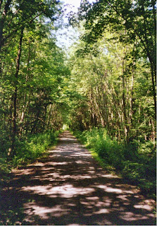
The resurfaced trail ended just before the Thruway, so we followed the unfinished path a little ways further (bringing back more thoughts of my first rides on this trail system) until we finally reached a point where it became so overgrown that it seemed pointless to keep going, just to end up at the same major road we'd stopped at previously. On the way back, we were lucky to see a fox go bounding down the hillside in front of us, across the trail, and into the woods.
Our first attempt at riding the new trail was very brief - we headed out on it from the Henrietta Highway Department and approximately a mile later found ourselves on a major road with no sign of where the trail continued. So we headed back to the car and drove down to Rush, and did the rest of the ride from there.

I'm always struck by how different this trail is now from when I first rode it, back in 2002 and 2003... back then it was a rough and ready rail bed, and only a crazy person would have ridden a narrow-tire road bike on it (that was my 2002 ride!) Even riding it with an ATB in 2003 was a challenge, between the flooded sections and the places where huge mounds of cinder had been piled (for eventual use in resurfacing the trail.) Now it's a fairly smooth stone dust trail... not as exciting to ride, but I suspect it gets a lot more use than it did before being resurfaced.

We rode from Rush out to the old Rochester Junction station (all that's left is a concrete and asphalt platform, mostly overgrown, through there is a very nice informational kiosk and a small picnic area. From there we headed northwest on the trail heading toward Rochester. At times the trail was bright and sunny (not the best option, on a hot July day) but there were also long wooded stretches which were great to ride through.

The resurfaced trail ended just before the Thruway, so we followed the unfinished path a little ways further (bringing back more thoughts of my first rides on this trail system) until we finally reached a point where it became so overgrown that it seemed pointless to keep going, just to end up at the same major road we'd stopped at previously. On the way back, we were lucky to see a fox go bounding down the hillside in front of us, across the trail, and into the woods.
The ride back was challenging, mainly because we were both getting pretty hot and tired. But eventually we made it back to Rush, and headed home for some well-deserved food (dinner, I guess) and cold, refreshing drinks.
This is a really nice trail system - it offers a great escape from the city and suburbs, and if you wanted to you could make full day of riding on it - plus it connects to the Genesee Valley Greenway south of Scottsville, the Auburn Trail over in Victor, and Genesee Valley Park (and thus both the Erie Canal trail and the Genesee Riverway) over in Rochester - that offers a tremendous number of options for riding! In most places the surface is good enough for a road bike, though a hybrid or mountain bike is probably the better option (there are places where the path is slightly washed out, and other spots where the stone dust is pretty loose.)
JMH
Saturday, July 28, 2007
30.3 Mile Ride from Scottsville Rd to Fairport & Back
Saturday, July 28, 2007
Ann had a dinner appointment, so I managed to get out on my bike for a ride this evening... started from the Public Safety Training Facility on Scottsville Rd and originally planned to ride to Pittsford & back, with maybe a side trip or two to bring the distance up to 20 miles. Instead, the riding bug bit and I ended up going all the way to Fairport, for a slightly longer ride... almost all of it along the Erie Canal.
The stretch from Pittsford to Fairport is a little tougher than the rest, because it's all dirt and crushed stone... nothing too hard, but it definitely takes more work than pedaling pavement. That stretch also runs over the Great Embankment, a 70 ft high one mile long stretch embankment that was built to carry the Erie Canal over the Irondequoit Valley. Two massive guard gates are set at each end, to seal off the section if the canal springs a leak in this area (and prevent it from flooding the valley - apparently, this happened in 1974 when contractors tunneling under the canal accidently broke through the bottom.) As usual, see Rich & Sue Freeman's Take Your Bike - Family Rides in the Rochester Area (2003) for more info.
On the way back, just before I hit Genesee Valley Park, I was stopped by a group of riders blocking the trail, who pointed out a hawk standing on the ground just off the trail... we watched him for a bit as he ripped apart the squirrel or whatever small mammal he'd nabbed for dinner. Pretty darn cool... shame I didn't have my camera with me (though it was getting darker by then, so I might not have been able to get a decent shot regardless.)
All in all, a good ride on a nice July evening!
JMH
Saturday, July 28, 2007
Ann had a dinner appointment, so I managed to get out on my bike for a ride this evening... started from the Public Safety Training Facility on Scottsville Rd and originally planned to ride to Pittsford & back, with maybe a side trip or two to bring the distance up to 20 miles. Instead, the riding bug bit and I ended up going all the way to Fairport, for a slightly longer ride... almost all of it along the Erie Canal.
The stretch from Pittsford to Fairport is a little tougher than the rest, because it's all dirt and crushed stone... nothing too hard, but it definitely takes more work than pedaling pavement. That stretch also runs over the Great Embankment, a 70 ft high one mile long stretch embankment that was built to carry the Erie Canal over the Irondequoit Valley. Two massive guard gates are set at each end, to seal off the section if the canal springs a leak in this area (and prevent it from flooding the valley - apparently, this happened in 1974 when contractors tunneling under the canal accidently broke through the bottom.) As usual, see Rich & Sue Freeman's Take Your Bike - Family Rides in the Rochester Area (2003) for more info.
On the way back, just before I hit Genesee Valley Park, I was stopped by a group of riders blocking the trail, who pointed out a hawk standing on the ground just off the trail... we watched him for a bit as he ripped apart the squirrel or whatever small mammal he'd nabbed for dinner. Pretty darn cool... shame I didn't have my camera with me (though it was getting darker by then, so I might not have been able to get a decent shot regardless.)
All in all, a good ride on a nice July evening!
JMH
Thursday, July 26, 2007
LONG DISTANCE 2007, Race #14
Forge the Gorgeous 8mi Trail Race
Thursday, July 26, 2007
2007 Forge the Gorgeous results
Forge the Gorgeous race info
2007 Forge the Gorgeous photo slideshow
hiking the gorge trail photo slideshow
Last year I was a bit surprised at how tough this race was... I guess having run it once helped, because while I still thought it was tough, it didn't seem as bad as it did a year ago. One thing remained constant - this is still a cool place to run!
I had originally hoped to get to Filmore Glen State Park 2 hours or so before the race, so that I'd have time to walk the gorge trail a bit and maybe take some non-running pictures. Needless to say, that plan didn't work and I ended up zipping into the park at (for me) the last minute, about 40 minutes before it was time to run. Met Jim and Loretta there, who had also given Ann a ride down with them. Changed into my running gear, and Ann and I took a few minutes to go see the Cow Sheds waterfall. Not as much water as last year, but still rather nice.

Once we got back to the parking lot, it was time to wander over to the starting area out by the road. The crowd was a little bit larger than last year, but this is still a pretty small race, even compared to many of the other ones I do. The RD had a few words to say (the usual pre-race stuff) and then it was time to run!
.JPG)
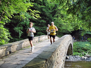
Took it easy across the grass and over the bridge, since I knew what was coming - a long uphill hike! That was tough, so early in the run, but at this point I've done enough trail races with long uphill hikes near the start that it wasn't that big of a deal. After half a mile or so the trail leveled out (somewhat) and I was able to run more consistently. Made it across the dam and into the first water stop at just under half an hour... not too bad, and the next bit was all downhill, along the opposite rim. Of course, downhill presents its own challenges, since that's where I'm most likely to blow out a knee...

After a short stop at the 2nd water stop to refill my water bottle and add some Gatorade mix, I headed up the gorge trail, which runs alongside the creek and crosses back and forth on eight wooden bridges. This was my favorite part of the run last year, and the same was true this year, despite the water level being very low.
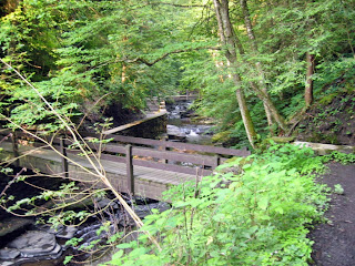

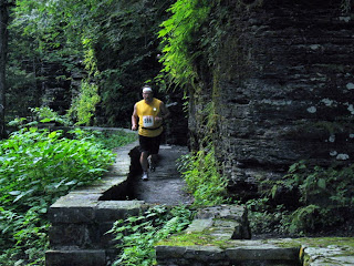
One thing was a bit surprising - the amount of climbing the gorge trail did. I remembered it being fairly level, but instead there's a good deal of up and down - nothing too steep or too long, but it was definitely work! Another surprise was that Ann had managed to hike all the way to the last waterfall, and was waiting there to take pictures (she also got some great shots of the gorge along the way.)
.JPG)
After that, it was time for the steep climb out of the gorge and then the long gradual uphill along the park road to the dam. That was really tough! But as the fellow at the water stop at the top of the hill pointed out, the remaining 2 1/4 miles would be 90% downhill... not quite the reassuring statement for me that it would be for some runners, but still better than running and hiking uphill!
A few of the downhill bits along that last stretch are pretty tricky - steep and slippery - so that slowed me down a bit. I was also surprised at how wobbly the first bridge I ran over was - didn't notice that when I'd crossed it earlier! Made my way through the woods and down the hill in fairly good time, then hustled across the bridge and used what little energy I had left to "sprint" to the finish, with a time of 1:32. Not bad at all, six minutes faster than last year!
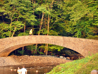
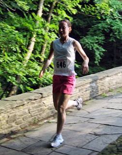
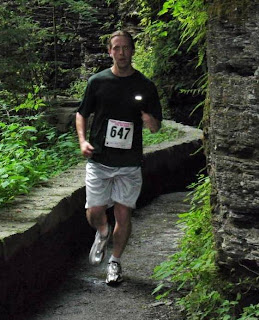
Jim and Loretta ran much faster than I did, as usual, crossing the finish line about 20 minutes before me, but both had the same reaction I did last year - "That was tough!" I did get the impression they enjoyed it (in a sick, torturous kind of way) and I'm glad I was able to encourage them to come down for the race.
a.jpg)
a.jpg)
Ann seems to have had a slightly better time than she usually does at a race (after all, watching a trail race is somewhat less interesting than watching grass grow) since she was able to do a little walking in the gorge while we were running. It was definitely nice to have her along for the ride to Rochester, especially since Mapquest gave me some convoluted directions and I needed her help navigating. All in all, I'm glad I did this one again, and I'm looking forward to maybe running it again next year!
Next up: Race the Train! Sure we all know I don't stand a chance (the train beat me by 20 minutes last year... I'd need to increase my pace by 2 1/2 minutes per mile to have a chance of beating it) but it was fun last year, and I may stay up that way afterwards and do a little riding. Maybe even the Adirondack Marathon course, as a preview for September's run...
JMH
2007 EVENT TOTALS
Running 147.3 mi, 34 hr 56 min
Cycling 26.2 mi, 1 hr 55 min
Snowshoe 31.3 mi, 9 hr 11 min
states visited: CT, MA, ME, NH, NY, VT
Forge the Gorgeous 8mi Trail Race
Thursday, July 26, 2007
2007 Forge the Gorgeous results
Forge the Gorgeous race info
2007 Forge the Gorgeous photo slideshow
hiking the gorge trail photo slideshow
Last year I was a bit surprised at how tough this race was... I guess having run it once helped, because while I still thought it was tough, it didn't seem as bad as it did a year ago. One thing remained constant - this is still a cool place to run!
I had originally hoped to get to Filmore Glen State Park 2 hours or so before the race, so that I'd have time to walk the gorge trail a bit and maybe take some non-running pictures. Needless to say, that plan didn't work and I ended up zipping into the park at (for me) the last minute, about 40 minutes before it was time to run. Met Jim and Loretta there, who had also given Ann a ride down with them. Changed into my running gear, and Ann and I took a few minutes to go see the Cow Sheds waterfall. Not as much water as last year, but still rather nice.
Once we got back to the parking lot, it was time to wander over to the starting area out by the road. The crowd was a little bit larger than last year, but this is still a pretty small race, even compared to many of the other ones I do. The RD had a few words to say (the usual pre-race stuff) and then it was time to run!
Took it easy across the grass and over the bridge, since I knew what was coming - a long uphill hike! That was tough, so early in the run, but at this point I've done enough trail races with long uphill hikes near the start that it wasn't that big of a deal. After half a mile or so the trail leveled out (somewhat) and I was able to run more consistently. Made it across the dam and into the first water stop at just under half an hour... not too bad, and the next bit was all downhill, along the opposite rim. Of course, downhill presents its own challenges, since that's where I'm most likely to blow out a knee...

After a short stop at the 2nd water stop to refill my water bottle and add some Gatorade mix, I headed up the gorge trail, which runs alongside the creek and crosses back and forth on eight wooden bridges. This was my favorite part of the run last year, and the same was true this year, despite the water level being very low.
One thing was a bit surprising - the amount of climbing the gorge trail did. I remembered it being fairly level, but instead there's a good deal of up and down - nothing too steep or too long, but it was definitely work! Another surprise was that Ann had managed to hike all the way to the last waterfall, and was waiting there to take pictures (she also got some great shots of the gorge along the way.)
After that, it was time for the steep climb out of the gorge and then the long gradual uphill along the park road to the dam. That was really tough! But as the fellow at the water stop at the top of the hill pointed out, the remaining 2 1/4 miles would be 90% downhill... not quite the reassuring statement for me that it would be for some runners, but still better than running and hiking uphill!
A few of the downhill bits along that last stretch are pretty tricky - steep and slippery - so that slowed me down a bit. I was also surprised at how wobbly the first bridge I ran over was - didn't notice that when I'd crossed it earlier! Made my way through the woods and down the hill in fairly good time, then hustled across the bridge and used what little energy I had left to "sprint" to the finish, with a time of 1:32. Not bad at all, six minutes faster than last year!
Jim and Loretta ran much faster than I did, as usual, crossing the finish line about 20 minutes before me, but both had the same reaction I did last year - "That was tough!" I did get the impression they enjoyed it (in a sick, torturous kind of way) and I'm glad I was able to encourage them to come down for the race.
a.jpg)
a.jpg)
Ann seems to have had a slightly better time than she usually does at a race (after all, watching a trail race is somewhat less interesting than watching grass grow) since she was able to do a little walking in the gorge while we were running. It was definitely nice to have her along for the ride to Rochester, especially since Mapquest gave me some convoluted directions and I needed her help navigating. All in all, I'm glad I did this one again, and I'm looking forward to maybe running it again next year!
Next up: Race the Train! Sure we all know I don't stand a chance (the train beat me by 20 minutes last year... I'd need to increase my pace by 2 1/2 minutes per mile to have a chance of beating it) but it was fun last year, and I may stay up that way afterwards and do a little riding. Maybe even the Adirondack Marathon course, as a preview for September's run...
JMH
2007 EVENT TOTALS
Running 147.3 mi, 34 hr 56 min
Cycling 26.2 mi, 1 hr 55 min
Snowshoe 31.3 mi, 9 hr 11 min
states visited: CT, MA, ME, NH, NY, VT
Wednesday, July 25, 2007
RANTING TURTLE
"No More Motorized Vehicles on Trails!"
Wednesday, July 25, 2007
Back when I first started running in the western Massachusetts state forests (in particular, Beartown and Mount Washington), ORVs were not all that common. In the 10 years since then, use of ORVs has skyrocketed, and the effect on the trails has been heartbreaking. When I went to Beartown two years ago, the two sections of trail I was on (one to run, the other to ride) were a mess. The MA Dept of Conservation and Recreation has closed the trails in Savoy to ORVs. And I saw extensive signs of trail damage in October Mountain State Forest, from huge scum-covered mudpuddles (usually with the trail widened to get past them or side trails cut to bypass them) to rocky, eroded downhills. 10 years ago these trails, used mainly by snowmobiles in the winter, were 8 feet wide... yesterday I ran through sections that had been widened to 15 feet or more by irresponsible users who just had to use that trail even though it was too muddy and wet for responsible riding.
From what I saw yesterday, I don't think the primary culprit at October Mountain State Forest is ATVs - I think it's trucks and SUVs being driven offroad. Three pickups blasted by me at the end of my run; one blasted by my car again later as I was driving out of the park. I was also passed on one trail by two kids in an SUV, and many of the tire tracks I saw seemed indicative of large vehicle use rather than ATVs.
So what exactly is gained by allowing motorized vehicles access to these trails? All I can see is a recreational opportunity for some folks, with part of that group behaving responsibly and another part behaving irresponsibly.
What is the price of this access? Damage to trails, increased greenhouse gas emission and use of petroleum, increased noise levels, and effects on non-motorized trail users ranging from irritation to outright danger.
To me, the cost far outweighs the benefit, which is why I say trails should be closed to motorized recreation. Unfortunately, that gives rise to the question of enforcement, which is a far more difficult issue. At several points where the paths/roads were gated, side paths had been cut through the woods to bypass the gates. Effective enforcement would require a much larger population of state rangers, among other things, and that's one reason why we'll probably never see this happen.
Some of the same arguments have been made in regards to banning mountain bikes from trails, particularly trail damage and hazards to trail users on foot. To be fair, there is an obnoxious subset of the riding population that have the same attitude as the irresponsible ORV users - the "I'm having fun and I can do whatever I want" group. At the same time, because biking has been banned in numerous locations, there seems to be a greater awareness on the part of the mountain biking organizations to encourage responsible behavior, as well as attempts to "give back" by performing trail maintenance and in some places ATB safety patrols. The two major differences I see are that mountain bikers simply will not cause the same degree of damage to the trails, unless huge numbers of them are riding in a particular area, and riding is an oxygen-fed, rather than a petroleum-fed, activity with much less impact on the global environment.
I doubt we'll ever see motorized vehicles banned entirely from recreational trail use, but I hope people someday realize that we're losing something precious - the natural environment around us - and perhaps at some point a compromise is reached. Hopefully before it's too late and all we have left are 15 foot wide torn up mudhole trails and eroded downhills.
And definitely lets find a way to have effective enforcement and get the irresponsible idiots off the trail who are determined the ruin things for the rest of us!
JMH
Tuesday, July 24, 2007
17 Mile Run at October Mountain State Forest
Tuesday, July 24, 2007
October Mountain State Forest official site
October Mountain State Forest trail map
October Mountain State Forest is the largest of Massachusetts state parks - its 16500 acres are home to miles of dirt roads, doubletrack, and singletack, as well as half a dozen ponds, lakes, and reservoirs. I ran there a little over 8 years ago, when I was first trying to get ready to run NIPMUCK, and had a fairly miserable run... I ran along the Appalachian Trail and ended up walking a lot of the time, either because the trail was too steep or too rocky. On the plus side, I remember spending 10 minutes watching a beaver swim in a pond - the first one I ever saw in the wild.
I planned today's run a little bit differently, adapting several the routes of several rides from two excellent mountain biking guides, Paul Angiolillo's Mountain Biking Southern New England and Anna Milkowski's Mountain Biking the Berkshires. In addition to the promise of no major climbs, this let me choose dirt roads and ORV trails, which I hoped would be a bit easier to run than the rocky singletrack I remembered from 1999...
Getting there was a bit of an adventure in and of itself. First I realized that I'd forgotten my camera, so I checked the disposables at the Lee travel plaza... for some reason, $16.99 for a disposable camera seemed like highway robbery (literally, in this case!) Then I reached one of the last turns I needed to make, and found the road blocked by a "no thru traffic" sign. So I ended up wandering over some roads that generally went in the right direction and hoped that the one I was looking for would have a sign when I reached it (it didn't, but I passed a side road indicated on my park map shortly after, so I made it! Of course, I found out after my run that if I'd stopped and checked my Berkshire County map, I could have gone directly to where I parked in about half the time and distance. Oh, well!)
Parked in a huge dirt lot (complete with numerous tire tracks from folks in ORVs tearing around... I'll rant about that more at the end) and geared up for my run, which I planned to split into 2 parts - 10 miles and 5 miles. Sprayed myself liberally with bug spray, despite loathing the stuff (that turned out to be a good move) and headed off down West Branch Rd toward Washington Mountain Marsh. Started out on a hard-packed dirt road, which was pleasantly easy running. After about a mile that turned into a multi-use trail through the woods that was fairly eroded and rocky in spots, but still nice running - shady and quiet.
Unfortunately, this was the point where the deerflies caught up with me... they weren't biting all that often, possibly due to the bug spray, but they buzzed around and landed in my hair, making a general nuisance of themselves. I crushed as many as I could, but reinforcements continued arriving for most of the first three hours, and after about 90 minutes I gave up and put on the hat I had with me, which at least kept them out of my hair. Fortunately it was cool enough to wear a hat!
Eventually the trail came out on another dirt road, which I ran mostly uphill and past an open viewpoint that gave some great views of the mountains to the northwest. That was one place where I really wished I had my camera. About six miles in, I headed back onto trails and was on trails and ORV roads for the rest of the first loop. Some uphill, some downhill, some eroded and rocky, and many places with deep scummy mudpuddles due to irresponsible ORV use (well, at least the multitude of frogs seemed happy... I suspect the 'skeeters like it too.)
Took one wrong turn (or rather, missed a turn) and ended up taking an access road past the northern end of Ashley Lake out to the paved road. Oh, well. That added about 2 miles to the first loop... found my way back to the trail I wanted, and took a 2nd intentional detour down the access road at the southern end of the lake (unfortunately, I mis-remembered reading that there was a 15 foot fountain of water at that end of the lake... rather ironic, since you can barely see the lake through the trees and undergrowth!) Continued on down the very eroded jeep road, and was passed at one point by two kids in an SUV - to their credit, they were very careful passing me. Passed the Sandwash Reservoir, which is the actual site of the fountain, but it wasn't running, unfortunately. Finally came back out on a hardpacked dirt road, and made the short run back to the car, with about 13.5 miles under my belt. (At the time, I thought it was only 12-12.5 miles...)
As I replaced my fluid bottles and munched some granola bars, I checked my map for 2nd loop possibilities... there was no way my legs would survive the original loop I'd planned to run at this point. I quicky decided on a 3.5 mile loop along the dirt roads surrounding the October Mountain reservoir, doused myself with more bug spray, and set out on my tired legs to complete the run.
Even though I ran all of this on fairly clear dirt roads, the time and distance I'd already spent on my feet were clearly taking their toll. It helped that much of the first half of the run was downhill, but that meant I'd be going uphill for the 2nd half... oh, well. The lowest point of the run passed between October Mountain Reservoir and a marsh, where I startled a heron (he flew off) and had a wonderful view of the moon rising over the marsh... another moment where my camera would have been nice. After a long uphill that included a lot of walking, I finally came out on County Road, the final stretch that would take me back to the car. Two pickups blazed by me along this part. Despite the general uphill trend, I managed a slow run back to the car, where I changed into dry clothes (on advantage of being out in the middle of nowhere - I was able to completely change instead of just changing my shirt, socks, and shoes), checked my Berkshire County map for the best route back to the main road (it turned out the be the road I'd just run up), and hit the road for the drive home.

the two loops I ran today...
So overall, a good LSD run (long slow distance) in a park I've been hoping to revisit for several years now. Ran a bit further than I intended, but that's OK. The ORV trails were also probably good practice for the 20 mile trail race at Savoy in mid-August - I've heard the terrain and footing are similar. I'm glad I ran there rather than riding my ATB, since many of the multi-use trails were in suffiiciently poor shape that I would have had a tough time riding on them. With luck I can find some time to go back and explore the west end of the park a bit... if not this summer, then maybe next year...
JMH
Tuesday, July 24, 2007
October Mountain State Forest official site
October Mountain State Forest trail map
October Mountain State Forest is the largest of Massachusetts state parks - its 16500 acres are home to miles of dirt roads, doubletrack, and singletack, as well as half a dozen ponds, lakes, and reservoirs. I ran there a little over 8 years ago, when I was first trying to get ready to run NIPMUCK, and had a fairly miserable run... I ran along the Appalachian Trail and ended up walking a lot of the time, either because the trail was too steep or too rocky. On the plus side, I remember spending 10 minutes watching a beaver swim in a pond - the first one I ever saw in the wild.
I planned today's run a little bit differently, adapting several the routes of several rides from two excellent mountain biking guides, Paul Angiolillo's Mountain Biking Southern New England and Anna Milkowski's Mountain Biking the Berkshires. In addition to the promise of no major climbs, this let me choose dirt roads and ORV trails, which I hoped would be a bit easier to run than the rocky singletrack I remembered from 1999...
Getting there was a bit of an adventure in and of itself. First I realized that I'd forgotten my camera, so I checked the disposables at the Lee travel plaza... for some reason, $16.99 for a disposable camera seemed like highway robbery (literally, in this case!) Then I reached one of the last turns I needed to make, and found the road blocked by a "no thru traffic" sign. So I ended up wandering over some roads that generally went in the right direction and hoped that the one I was looking for would have a sign when I reached it (it didn't, but I passed a side road indicated on my park map shortly after, so I made it! Of course, I found out after my run that if I'd stopped and checked my Berkshire County map, I could have gone directly to where I parked in about half the time and distance. Oh, well!)
Parked in a huge dirt lot (complete with numerous tire tracks from folks in ORVs tearing around... I'll rant about that more at the end) and geared up for my run, which I planned to split into 2 parts - 10 miles and 5 miles. Sprayed myself liberally with bug spray, despite loathing the stuff (that turned out to be a good move) and headed off down West Branch Rd toward Washington Mountain Marsh. Started out on a hard-packed dirt road, which was pleasantly easy running. After about a mile that turned into a multi-use trail through the woods that was fairly eroded and rocky in spots, but still nice running - shady and quiet.
Unfortunately, this was the point where the deerflies caught up with me... they weren't biting all that often, possibly due to the bug spray, but they buzzed around and landed in my hair, making a general nuisance of themselves. I crushed as many as I could, but reinforcements continued arriving for most of the first three hours, and after about 90 minutes I gave up and put on the hat I had with me, which at least kept them out of my hair. Fortunately it was cool enough to wear a hat!
Eventually the trail came out on another dirt road, which I ran mostly uphill and past an open viewpoint that gave some great views of the mountains to the northwest. That was one place where I really wished I had my camera. About six miles in, I headed back onto trails and was on trails and ORV roads for the rest of the first loop. Some uphill, some downhill, some eroded and rocky, and many places with deep scummy mudpuddles due to irresponsible ORV use (well, at least the multitude of frogs seemed happy... I suspect the 'skeeters like it too.)
Took one wrong turn (or rather, missed a turn) and ended up taking an access road past the northern end of Ashley Lake out to the paved road. Oh, well. That added about 2 miles to the first loop... found my way back to the trail I wanted, and took a 2nd intentional detour down the access road at the southern end of the lake (unfortunately, I mis-remembered reading that there was a 15 foot fountain of water at that end of the lake... rather ironic, since you can barely see the lake through the trees and undergrowth!) Continued on down the very eroded jeep road, and was passed at one point by two kids in an SUV - to their credit, they were very careful passing me. Passed the Sandwash Reservoir, which is the actual site of the fountain, but it wasn't running, unfortunately. Finally came back out on a hardpacked dirt road, and made the short run back to the car, with about 13.5 miles under my belt. (At the time, I thought it was only 12-12.5 miles...)
As I replaced my fluid bottles and munched some granola bars, I checked my map for 2nd loop possibilities... there was no way my legs would survive the original loop I'd planned to run at this point. I quicky decided on a 3.5 mile loop along the dirt roads surrounding the October Mountain reservoir, doused myself with more bug spray, and set out on my tired legs to complete the run.
Even though I ran all of this on fairly clear dirt roads, the time and distance I'd already spent on my feet were clearly taking their toll. It helped that much of the first half of the run was downhill, but that meant I'd be going uphill for the 2nd half... oh, well. The lowest point of the run passed between October Mountain Reservoir and a marsh, where I startled a heron (he flew off) and had a wonderful view of the moon rising over the marsh... another moment where my camera would have been nice. After a long uphill that included a lot of walking, I finally came out on County Road, the final stretch that would take me back to the car. Two pickups blazed by me along this part. Despite the general uphill trend, I managed a slow run back to the car, where I changed into dry clothes (on advantage of being out in the middle of nowhere - I was able to completely change instead of just changing my shirt, socks, and shoes), checked my Berkshire County map for the best route back to the main road (it turned out the be the road I'd just run up), and hit the road for the drive home.

the two loops I ran today...
So overall, a good LSD run (long slow distance) in a park I've been hoping to revisit for several years now. Ran a bit further than I intended, but that's OK. The ORV trails were also probably good practice for the 20 mile trail race at Savoy in mid-August - I've heard the terrain and footing are similar. I'm glad I ran there rather than riding my ATB, since many of the multi-use trails were in suffiiciently poor shape that I would have had a tough time riding on them. With luck I can find some time to go back and explore the west end of the park a bit... if not this summer, then maybe next year...
JMH
Monday, July 23, 2007
COHOES FALLS, BROKEN CHAIN
13.2 Mile Ride Along the Mohawk-Hudson Bike Path
(& a 4 Mile Hike Along the Bike Path!)
Monday, July 23, 2007
The rain we had for much of the day caused me to drag my heels about getting outside on my bike (well, running some errands and then riding) and in the end I decided to stay closer to home rather than go over to the bike path west of Schenectady, in case it started raining hard. So in the end I headed over to the Niskayuna Lions Park and headed east on the path, even though I'd run there yesterday.
Just after the road to the Colonie Water Treatment Plant, there was a doe standing on the path... I got to within about 10 feet of her before she decided to run into the bushes. No surprise, I also passed lots o' bunnies. Big bunnies, bitty bunnies, and between bunnies. The cottontail population is booming in Colonie...
On a whim, I decided to ride past Colonie Town Park (apparently, now renamed the Colonie Mohawk River Park) and down to Cohoes Falls. Originally the water flow over the falls was impressive year-round; now, it's often non-existent in the summer, as water is diverted from the falls to run a nearby power station and fill the Barge Canal (which bypasses the falls by running northeast of the river through a fairly impressive flight of locks designed to take the canal down the escarpment.) I was a bit curious to see if the rain had provided any water for the falls, and I suspect I was also hankering to ride someplace different from my usual haunts.
They've done a lot of work to improve the Cohoes Falls overlook park - the first couple of times I went there, it was, quite frankly, a somewhat scary looking dump. Now it's very scenic, and gives pretty nice views of the falls and the gorge. There was a little water going over the falls - more than I'd expected, actually. I ended up wishing I'd brought my camera - fortunately, the USGS provides photos of the falls from their gaging station downstream, updated several times a day.
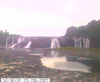
photo from the USGS gaging station
After that I ended up exploring a bit - headed up the road, rather than straight back to the bike path, and eventually found my way back to the path just before the Colonie Mohawk River Park. Along here my chain started skipping a bit, leading me to suspect that I need to make further adjustments to account for the new position of the handlebars. Annoying, but nothing I couldn't work around.
At least until I got to the bottom of the last steep hill, downshifted, and had the chain break when I cranked down on the pedals.
Don't know if the skipping was because the chain was getting ready to go or if the chain went because of all the skipping. In any case, I've no doubt it's my fault - I shortened the chain by a couple of links about a month ago, and when I put it back together the join didn't feel totally right - I suspect the rivet was slightly misaligned.
Since I don't have a chain tool in my kit, I dropped the chain in the first garbage can I found and pushed the bike the remaining 4 miles back to the car. (Well... I was able to coast along two parts that ran slightly downhill.) Annoying, but it could have been worse. I could have been pushing the bike along a road, or the chain could have snapped 8 miles from the car. It could have been raining, or warm enough that the 'skeeters were swarming. And at least I got to see a heron in the midst of a flock of canada geese on the river...
Stopped at Walmart on the way home, and the bike now has a new chain. There is also a small chain tool in my tool kit - it would have been messy reattaching the chain tonight, but it would have gotten me back to the car quicker than walking!
JMH
13.2 Mile Ride Along the Mohawk-Hudson Bike Path
(& a 4 Mile Hike Along the Bike Path!)
Monday, July 23, 2007
The rain we had for much of the day caused me to drag my heels about getting outside on my bike (well, running some errands and then riding) and in the end I decided to stay closer to home rather than go over to the bike path west of Schenectady, in case it started raining hard. So in the end I headed over to the Niskayuna Lions Park and headed east on the path, even though I'd run there yesterday.
Just after the road to the Colonie Water Treatment Plant, there was a doe standing on the path... I got to within about 10 feet of her before she decided to run into the bushes. No surprise, I also passed lots o' bunnies. Big bunnies, bitty bunnies, and between bunnies. The cottontail population is booming in Colonie...
On a whim, I decided to ride past Colonie Town Park (apparently, now renamed the Colonie Mohawk River Park) and down to Cohoes Falls. Originally the water flow over the falls was impressive year-round; now, it's often non-existent in the summer, as water is diverted from the falls to run a nearby power station and fill the Barge Canal (which bypasses the falls by running northeast of the river through a fairly impressive flight of locks designed to take the canal down the escarpment.) I was a bit curious to see if the rain had provided any water for the falls, and I suspect I was also hankering to ride someplace different from my usual haunts.
They've done a lot of work to improve the Cohoes Falls overlook park - the first couple of times I went there, it was, quite frankly, a somewhat scary looking dump. Now it's very scenic, and gives pretty nice views of the falls and the gorge. There was a little water going over the falls - more than I'd expected, actually. I ended up wishing I'd brought my camera - fortunately, the USGS provides photos of the falls from their gaging station downstream, updated several times a day.

photo from the USGS gaging station
After that I ended up exploring a bit - headed up the road, rather than straight back to the bike path, and eventually found my way back to the path just before the Colonie Mohawk River Park. Along here my chain started skipping a bit, leading me to suspect that I need to make further adjustments to account for the new position of the handlebars. Annoying, but nothing I couldn't work around.
At least until I got to the bottom of the last steep hill, downshifted, and had the chain break when I cranked down on the pedals.
Don't know if the skipping was because the chain was getting ready to go or if the chain went because of all the skipping. In any case, I've no doubt it's my fault - I shortened the chain by a couple of links about a month ago, and when I put it back together the join didn't feel totally right - I suspect the rivet was slightly misaligned.
Since I don't have a chain tool in my kit, I dropped the chain in the first garbage can I found and pushed the bike the remaining 4 miles back to the car. (Well... I was able to coast along two parts that ran slightly downhill.) Annoying, but it could have been worse. I could have been pushing the bike along a road, or the chain could have snapped 8 miles from the car. It could have been raining, or warm enough that the 'skeeters were swarming. And at least I got to see a heron in the midst of a flock of canada geese on the river...
Stopped at Walmart on the way home, and the bike now has a new chain. There is also a small chain tool in my tool kit - it would have been messy reattaching the chain tonight, but it would have gotten me back to the car quicker than walking!
JMH
Saturday, July 21, 2007
14 Mile Ride at the Corning Preserve
Saturday, July 21, 2007

not exactly my Kent Denali, since I've replaced the pedals & toe clips, seat, brake levers, brake pads, freewheel, water bottle cage, and rear spokes, as well as adding better bar wrap, a pump, cycle computer, and seat bag for tools and spare tubes...
One of the things I haven't liked about the Kent bicycle I bought last summer was the lack of height adjustment on the bar stem... at most I was able to change to height of the handlebars by 5 mm or so. Since I tend to ride in an upright position - not terribly aerodynamic, but I'm slow, so that's not quite as important - I've always found it to be a little bit uncomfortable, though I've gotten used to it as I've ridden the bike more. After trying several methods of raising the bars, I finally settled on a Delta Stem Riser, which I installed on Thursday.

A short test ride Thursday afternoon showed that I was on the right track - my riding position was much more comfortable, though I need to get used to my center of gravity being higher again - but some tweaking was still necessary. So today after class I made some adjustments and then headed down to the Corning Preserve to see whether or not that had done the trick.
Another chilly evening, so most of the path was fairly quiet, though the waterfront park was busy as usual with summer picnics. All in all, a nice ride along the river and through Schuyler Flatts Cultural Park. And at the end, as I was loading my bike back on the car, I watched the Livingston Avenue Railroad Bridge rotate to allow a large tour boat through. The bridge is a swing bridge, which rotates to open two channels that larger boats can use to pass through the rail line. Apparently, initial plans were developed almost 10 years to rehabilitate the bridge with an attached pedestrian walkway connecting the Albany and Rensselaer, but so far nothing has come of the idea.

photo courtesy of Wikipedia
JMH
Saturday, July 21, 2007

not exactly my Kent Denali, since I've replaced the pedals & toe clips, seat, brake levers, brake pads, freewheel, water bottle cage, and rear spokes, as well as adding better bar wrap, a pump, cycle computer, and seat bag for tools and spare tubes...
One of the things I haven't liked about the Kent bicycle I bought last summer was the lack of height adjustment on the bar stem... at most I was able to change to height of the handlebars by 5 mm or so. Since I tend to ride in an upright position - not terribly aerodynamic, but I'm slow, so that's not quite as important - I've always found it to be a little bit uncomfortable, though I've gotten used to it as I've ridden the bike more. After trying several methods of raising the bars, I finally settled on a Delta Stem Riser, which I installed on Thursday.

A short test ride Thursday afternoon showed that I was on the right track - my riding position was much more comfortable, though I need to get used to my center of gravity being higher again - but some tweaking was still necessary. So today after class I made some adjustments and then headed down to the Corning Preserve to see whether or not that had done the trick.
Another chilly evening, so most of the path was fairly quiet, though the waterfront park was busy as usual with summer picnics. All in all, a nice ride along the river and through Schuyler Flatts Cultural Park. And at the end, as I was loading my bike back on the car, I watched the Livingston Avenue Railroad Bridge rotate to allow a large tour boat through. The bridge is a swing bridge, which rotates to open two channels that larger boats can use to pass through the rail line. Apparently, initial plans were developed almost 10 years to rehabilitate the bridge with an attached pedestrian walkway connecting the Albany and Rensselaer, but so far nothing has come of the idea.

photo courtesy of Wikipedia
JMH
Friday, July 20, 2007
13 Mile Run at Thacher State Park
Friday, July 20, 2007
Decided I really didn't want to spend hours in the car today and went to Thacher instead of October Mountain State Forest in MA. Besides, I had to make up for missing the Indian Ladder Trail Run this year. :-)
Apparently they're still not charging admission on weekdays, at least not late on Friday afternoon. Actually, Thacher was the quietest I've ever seen it - probably in part because much of the day today was cloudy (and there were still clouds over the Helderbergs when I got there) and between the temperature (mid 70's) and the windchill, it was downright cold up there! Felt more like October than July... not that I'm complaining, I'd much rather chilly weather than the heat and humidity we'll no doubt be suffering through soon.
Parked at the Paint Mine lot and headed off along the escarpment and up into the OSI property, where the latter parts of the Indian Ladder 15k and Hairy Gorilla Half Marathon are run. The trails were the clearest I've ever seen them - brush cut way back and well mowed. I can remember the first few times we raced up there - parts of the trail were barely singletrack!
Along the way I startled a female spruce grouse (at least, I think that's what she was) - she flew up out of the plants on one side of the path into the thick brush on the other side and set to making quite a racket. When I stopped to see if I could catch a glimpse of her, half a dozen chicks flew up from where she'd come from and into the brush after her! I managed a brief glimpse of her through the branches... then decided it was time to be moving and stop disturbing them.
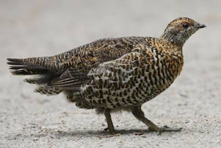.jpg)
photo courtesy of Wikipedia
Diverted off the IL course into HG country, and even took a loop trail I don't think I've run before, along doubletrack, the edges of some cornfields, and back onto singletrack. Ran up through the quarry and then back onto the IL course, around the pond, past the Ryan Rd trailhead, and then back down through the Haile's Cave picnic area and along the escarpment to Paint Mine and the car, where I swapped in new bottles of Gatorade and water, changed into a dry shirt and new socks, and then headed up Paint Mine Road.
I was a bit disappointed running up the hill, given that by this time last summer I was able to run up it without stopping and today I stopped several times to walk and catch my breath. At the top the trail runs parallel to Beaver Dam Rd, and at the point where the IL route turns to head down the hill, I went straight to add in the longer blue trail loop, rejoining the IL route a ways down the hill. I diverged from the IL course a little further along, running down to the field just above the maintenance garage and up the hill to the old water tank. I would have liked to run the Hop Field trails, but I was a bit concerned that I wouldn't get back to the parking lot in time and I'd find the barrier locked... so instead I made my way through the woods and down the long hill to the stream. Even ran through the stream, just like during the race - that water was cold! But it felt kind of good on my tired feet...
Overall, a decent run... I got to run parts of the trail that I missed running on Sunday, and parts of the Hairy Gorilla course, but also some trails that aren't in either race. One thing that became very clear during this run is that I need to do more hill work, specifically uphill running - I can't do much to get faster on the downhills (too much risk to my knees) so I definitely need to get stronger at running uphills. I suspect some runs up to Roemer's High Point are waiting in the not to distant future...
JMH
Friday, July 20, 2007
Decided I really didn't want to spend hours in the car today and went to Thacher instead of October Mountain State Forest in MA. Besides, I had to make up for missing the Indian Ladder Trail Run this year. :-)
Apparently they're still not charging admission on weekdays, at least not late on Friday afternoon. Actually, Thacher was the quietest I've ever seen it - probably in part because much of the day today was cloudy (and there were still clouds over the Helderbergs when I got there) and between the temperature (mid 70's) and the windchill, it was downright cold up there! Felt more like October than July... not that I'm complaining, I'd much rather chilly weather than the heat and humidity we'll no doubt be suffering through soon.
Parked at the Paint Mine lot and headed off along the escarpment and up into the OSI property, where the latter parts of the Indian Ladder 15k and Hairy Gorilla Half Marathon are run. The trails were the clearest I've ever seen them - brush cut way back and well mowed. I can remember the first few times we raced up there - parts of the trail were barely singletrack!
Along the way I startled a female spruce grouse (at least, I think that's what she was) - she flew up out of the plants on one side of the path into the thick brush on the other side and set to making quite a racket. When I stopped to see if I could catch a glimpse of her, half a dozen chicks flew up from where she'd come from and into the brush after her! I managed a brief glimpse of her through the branches... then decided it was time to be moving and stop disturbing them.
.jpg)
photo courtesy of Wikipedia
Diverted off the IL course into HG country, and even took a loop trail I don't think I've run before, along doubletrack, the edges of some cornfields, and back onto singletrack. Ran up through the quarry and then back onto the IL course, around the pond, past the Ryan Rd trailhead, and then back down through the Haile's Cave picnic area and along the escarpment to Paint Mine and the car, where I swapped in new bottles of Gatorade and water, changed into a dry shirt and new socks, and then headed up Paint Mine Road.
I was a bit disappointed running up the hill, given that by this time last summer I was able to run up it without stopping and today I stopped several times to walk and catch my breath. At the top the trail runs parallel to Beaver Dam Rd, and at the point where the IL route turns to head down the hill, I went straight to add in the longer blue trail loop, rejoining the IL route a ways down the hill. I diverged from the IL course a little further along, running down to the field just above the maintenance garage and up the hill to the old water tank. I would have liked to run the Hop Field trails, but I was a bit concerned that I wouldn't get back to the parking lot in time and I'd find the barrier locked... so instead I made my way through the woods and down the long hill to the stream. Even ran through the stream, just like during the race - that water was cold! But it felt kind of good on my tired feet...
Overall, a decent run... I got to run parts of the trail that I missed running on Sunday, and parts of the Hairy Gorilla course, but also some trails that aren't in either race. One thing that became very clear during this run is that I need to do more hill work, specifically uphill running - I can't do much to get faster on the downhills (too much risk to my knees) so I definitely need to get stronger at running uphills. I suspect some runs up to Roemer's High Point are waiting in the not to distant future...
JMH
Tuesday, July 17, 2007
10.5 Mile Ride Along the Genesee Riverway, Through Turning Point Park, and Along the Rochester Running Track Railbed
Tuesday, July 17, 2007
photo slideshow
Legs didn't feel up to a run yet, so Ann and I took our ATBs out for a ride, first up at Turning Point Park and along the Genesee Riverway, and then over across the river along the Rochester Running Track railbed next to Seneca Park.
We started at Turning Point and went down on the boardwalk along the edge of the river that I ran and we rode back at the end of June. Once again we saw lots of turtles, the swans and their cygnet, ducks, and the heron. While we were there, a tugboat was pushing the cement boat down the river toward the cement company dock.

On the way back to Turning Point, we got to see a kingfisher swoooping around (he even landed briefly on the boardwalk railing just ahead of us) and Ann spotted a black rat snake curled up on a patch of reeds. After walking the bikes up the short steep hill, we headed into the woods and rode over to Red Falls. Riding through the shady woods was nice after being out on the boardwalk!
Originally I had planned to leave the car at Turning Point and ride the Riverway down to the Pure Waters pedestrian bridge across the river into Seneca Park. Between the somewhat shady characters hanging out at the Turning Point parking lot and all the sidewalk we'd have to ride between there and the bridge, we decided instead to drive over to Seneca Park and ride the east side out of there. After parking in one of the zoo lots, we rode down to the pedestrian bridge and up the long hill to the rim of the gorge on the other side, then back the way we came. The last time we were at the bridge, we watched deer walking around in the wooded area far beneath the bridge - this time the only thing to see was the view of the gorge in either direction.
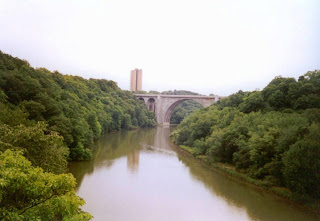
From there we headed out of the park and onto the old railbed... this is one that hasn't been resurfaced, so it's definitely for the rough-and-ready. Lots of rocky ballast stone made for a bumpy ride in some spots, as did a certain amount of overgrowth. Along the way we passed the Seneca Park Zoo, where we caught glimpses of the wallabies, a tiger, and a rather sad-looking elephant. (I generally think it's a shame to see these lovely animals penned up in zoos... but I think it's an even bigger shame that for some of these critters, being in a zoo is the best chance they have to survive... it's a horrible thought that someday the only african elephants left may be the ones in zoos.) We also startled a number of birds, including the usual robins and goldfinches but also some birds I hadn't seen before - I've since identified them as yellow-shafted Northern Flickers, and apparently they were down on the trail because they love to eat ants.

photo courtesy of Ken Thomas
I had originally hoped to ride almost all the way to the Lake, but about 3/4 of a mile past the park we hit a bad washout that left a major gap in the railbed, and it didn't make sense to try to walk to bikes to the other side just to get in a little more riding. So we turned around an headed back to the trailhead, shaving a few minutes off the return trip by squeezing through a narrow gap in the fence between the railbed and the park just a hundred feet or so from where we'd parked the car.
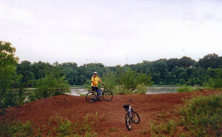
JMH
Tuesday, July 17, 2007
photo slideshow
Legs didn't feel up to a run yet, so Ann and I took our ATBs out for a ride, first up at Turning Point Park and along the Genesee Riverway, and then over across the river along the Rochester Running Track railbed next to Seneca Park.
We started at Turning Point and went down on the boardwalk along the edge of the river that I ran and we rode back at the end of June. Once again we saw lots of turtles, the swans and their cygnet, ducks, and the heron. While we were there, a tugboat was pushing the cement boat down the river toward the cement company dock.

On the way back to Turning Point, we got to see a kingfisher swoooping around (he even landed briefly on the boardwalk railing just ahead of us) and Ann spotted a black rat snake curled up on a patch of reeds. After walking the bikes up the short steep hill, we headed into the woods and rode over to Red Falls. Riding through the shady woods was nice after being out on the boardwalk!
Originally I had planned to leave the car at Turning Point and ride the Riverway down to the Pure Waters pedestrian bridge across the river into Seneca Park. Between the somewhat shady characters hanging out at the Turning Point parking lot and all the sidewalk we'd have to ride between there and the bridge, we decided instead to drive over to Seneca Park and ride the east side out of there. After parking in one of the zoo lots, we rode down to the pedestrian bridge and up the long hill to the rim of the gorge on the other side, then back the way we came. The last time we were at the bridge, we watched deer walking around in the wooded area far beneath the bridge - this time the only thing to see was the view of the gorge in either direction.

From there we headed out of the park and onto the old railbed... this is one that hasn't been resurfaced, so it's definitely for the rough-and-ready. Lots of rocky ballast stone made for a bumpy ride in some spots, as did a certain amount of overgrowth. Along the way we passed the Seneca Park Zoo, where we caught glimpses of the wallabies, a tiger, and a rather sad-looking elephant. (I generally think it's a shame to see these lovely animals penned up in zoos... but I think it's an even bigger shame that for some of these critters, being in a zoo is the best chance they have to survive... it's a horrible thought that someday the only african elephants left may be the ones in zoos.) We also startled a number of birds, including the usual robins and goldfinches but also some birds I hadn't seen before - I've since identified them as yellow-shafted Northern Flickers, and apparently they were down on the trail because they love to eat ants.

photo courtesy of Ken Thomas
I had originally hoped to ride almost all the way to the Lake, but about 3/4 of a mile past the park we hit a bad washout that left a major gap in the railbed, and it didn't make sense to try to walk to bikes to the other side just to get in a little more riding. So we turned around an headed back to the trailhead, shaving a few minutes off the return trip by squeezing through a narrow gap in the fence between the railbed and the park just a hundred feet or so from where we'd parked the car.

JMH
Monday, July 16, 2007
ANOTHER AFTERNOON OF (BRIEFLY) HIKING THE TRAILS OF PENFIELD
Monday, July 16, 2007
Penfield Parks Trails info (includes links to trail maps)
Wegmans Passport to Family Wellness program
After yesterday's race and hiking, my legs were feeling more than a bit fried. Combine that with the on-and-off drizzle we had this morning and early afternoon, and it becomes fairly clear why Ann and I decided to try some easy walks today - which would also give us a chance to add a few more sites to our Wegmans Passports!
Wild Iris Trail - this was the first trail we visited today, and one of the shortest walks of the thirteen options. The Wild Iris Trail runs through the Genesee Land Trust's Hipp Brook Preserve, one of only three Class 1 wetlands in Penfield. We parked at the trailhead (actually, along the side of a suburban road), doused ourselves with bug spray, and headed into the woods. I very quickly headed back out again to return to the car for a hat, because the deerflies descended on me in swarms. Even with the hat, it was a very buggy walk, and we moved pretty quickly along the wood chip trails and the short boardwalk. Not much to see - woods and swamp - and we finally bailed out at a second trailhead and walked along the streets to get back to the car, in hopes that we'd be able to leave the deerflies behind. That helped... but we really only got rid of them when we jumped in the car and drove off. trail map (PDF)
Monday, July 16, 2007
Penfield Parks Trails info (includes links to trail maps)
Wegmans Passport to Family Wellness program

After yesterday's race and hiking, my legs were feeling more than a bit fried. Combine that with the on-and-off drizzle we had this morning and early afternoon, and it becomes fairly clear why Ann and I decided to try some easy walks today - which would also give us a chance to add a few more sites to our Wegmans Passports!
Wild Iris Trail - this was the first trail we visited today, and one of the shortest walks of the thirteen options. The Wild Iris Trail runs through the Genesee Land Trust's Hipp Brook Preserve, one of only three Class 1 wetlands in Penfield. We parked at the trailhead (actually, along the side of a suburban road), doused ourselves with bug spray, and headed into the woods. I very quickly headed back out again to return to the car for a hat, because the deerflies descended on me in swarms. Even with the hat, it was a very buggy walk, and we moved pretty quickly along the wood chip trails and the short boardwalk. Not much to see - woods and swamp - and we finally bailed out at a second trailhead and walked along the streets to get back to the car, in hopes that we'd be able to leave the deerflies behind. That helped... but we really only got rid of them when we jumped in the car and drove off. trail map (PDF)
Veterans Memorial Park Fitness Trail & Nature Trail - Next we headed a short distance up the road to the Veterans Memorial Park, which actually has two Passport markers - one for the paved fitness trail, and one for the wooded nature trail. We started out by visiting the Don Mack Rock Garden, which had a number of interesting rocks, trees, and plants (at least, I thought they were interesting!) Then we headed over to the nature trail, recorded our visit in our booklets, and took a short walk through the woods. While the deerflies weren't as much of a problem, here we met a number of mosquitoes, which convinced us to cut our woods walk short just after we'd walked behind the fishing pond (where we saw lots of frogs!) We visited the Passport marker along the paved fitness trail, walked part of the perimeter of the soccer field, and then headed across the field back to the car to escape the bugs. trail map (PDF)
Thousand Acre Swamp - Since the Nature Conservancy's Thousand Acre Swamp Preserve is just up the road from Veteran's Memorial Park, we headed there for our final walk of the day. We visited the Thousand Acre Swamp a number of years ago, but not in the summer - given our experiences at the other two parks, we expected it to be very buggy and were unfortunately correct! So we settled for checking out the trailhead kiosk, marking our booklets, and picking up some Preserve info, rather than spending a lot of time donating blood to the 'skeeters and deerflies. I remember enjoying the trails there when we last walked them; perhaps I'll get a chance to go over there and run sometime this summer...
So not much walking, and lots of bugs... not the most successful of hiking expeditions. But we did manage to record four more markers in our booklets, leaving us with only four more to completely fill the Passport (and only one more to qualify for the drawing for the catered picnic - we qualified for our T-shirts today.)
JMH
Sunday, July 15, 2007
White Deer at the Seneca Army Depot
Sunday, July 15, 2007
On our way back home tonight, we ended up driving up the east shore of Seneca Lake, and as we passed Sampson State Park and the old Seneca Army Depot I mentioned reading that there was a rare herd of white deer on the Army Depot property, to which Ann responded that I'd said that before but we'd yet to see any white deer.
Looks like it was our lucky night, because a few minutes later she hollered that she'd seen one!
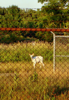
Took a while to get turned around (and along the way we saw many brown deer) but when we did, there were two white deer in the area where she'd seen the first one. We stopped and watched them for a few minutes; while we were there, several other cars stopped too. Apparently the white deer are quite a draw!
From what I've been able to find out, there is a herd of approximately 300 white deer on the closed 10600 acre military base. When 7500 acres of the property was fenced in by the military in the mid-1900's, the existing herds of deer were geographically confined and restricted breeding caused expression of a recessive gene for white coats. A base commander in the 1950's spotted a white buck and ordered the white deer protected from hunting, and over time the white coats became more and more prevalent, resulting in the largest herd of white deer in the world.
Seneca County is currently looking at various ways to use the land. There's a not-for-profit organization, Seneca White Deer Inc, devoted to saving as much of the Depot as possible for a conservation area and military museum.
JMH
Sunday, July 15, 2007
On our way back home tonight, we ended up driving up the east shore of Seneca Lake, and as we passed Sampson State Park and the old Seneca Army Depot I mentioned reading that there was a rare herd of white deer on the Army Depot property, to which Ann responded that I'd said that before but we'd yet to see any white deer.
Looks like it was our lucky night, because a few minutes later she hollered that she'd seen one!
Took a while to get turned around (and along the way we saw many brown deer) but when we did, there were two white deer in the area where she'd seen the first one. We stopped and watched them for a few minutes; while we were there, several other cars stopped too. Apparently the white deer are quite a draw!
From what I've been able to find out, there is a herd of approximately 300 white deer on the closed 10600 acre military base. When 7500 acres of the property was fenced in by the military in the mid-1900's, the existing herds of deer were geographically confined and restricted breeding caused expression of a recessive gene for white coats. A base commander in the 1950's spotted a white buck and ordered the white deer protected from hunting, and over time the white coats became more and more prevalent, resulting in the largest herd of white deer in the world.
Seneca County is currently looking at various ways to use the land. There's a not-for-profit organization, Seneca White Deer Inc, devoted to saving as much of the Depot as possible for a conservation area and military museum.
JMH
ITHACA IS GORGES
Hiking at Buttermilk Falls State Park & Robert Treman State Park
Sunday, July 15, 2007
Why are there so many gorges in the Finger Lakes region?
Buttermilk Falls State Park official site
Robert Treman State Park official site
Buttermilk Falls photo slideshow
Robert Treman State Park photo slideshow
Apparently "Ithaca is Gorges" is a popular slogan in the Ithaca area, in part because of the number of gorges and waterfalls in relatively close proximity to the city. Last year Ann and I visited Taughannock Falls State Park, just a little ways northwest of Ithaca, and I ran a race at the Filmore Glen State Park to the northeast. Since we were in the area anyways (and since Ann had spent a fairly boring 2 1/2 hours waiting for me to run the Forest Frolic 15k) we decided that after grabbing some lunch we'd do a little hiking at two of the local state parks, both with gorges and waterfalls. After all, what sensible person wouldn't want to spend the afternoon hiking up and down steep trails and stairways after spending two hours running up and down hilly trails in the morning?
Buttermilk Falls State Park


The weather didn't look too promising when we arrived at Buttermilk Falls, but it turned out to be a fairly nice afternoon (though a bit warm and humid.) We spotted the main waterfall immediately on driving into the park - shame they had to go and make the pool beneath the falls a swimming area, but I imagine that brings in a lot of revenue for the park and helps it stay open for people like Ann and me to hike the trails!

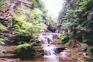
We chose to hike up and back on the gorge trail; the rim trail just didn't seem to offer much in the way of views of the stream and waterfalls. Hike "up" is a good description - between the lower parking area and the road at the top of the gorge, there were many, many, many steps and lots of hills, both gradual and steep, but very few level stretches of trail. The gorge was beautiful, with all sorts of cool rock formations and multiple waterfalls. At least that gave us plenty of excuses to stop and catch our breath...


We climbed out of the gorge and visited the upper parking area for a quick rest stop at the top, about 3/4 of a mile from where we started. Then it was time for the climb back down... my bad knees are not fond of downhills, and adding in my legs being somewhat thrashed from the race this morning meant it was very slow going. I was also very hot and a bit dehydrated... I enjoyed the trip back through the gorge (except for all the people who'd appeared, now that the weather was looking better) but was definitely tired and cranky by the time we reached the bottom. But the cool (well, not too warm) drinks waiting in the car helped revive me as we made the five minute drive to the 2nd leg of our Ithaca hiking adventure.
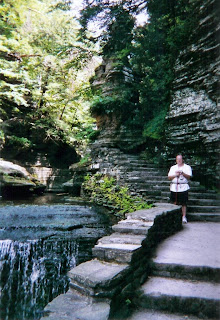
As a quick aside, I have since learned that the Finger Lakes Runners Club holds a 10k trail race at Buttermilk Falls in early June... unfortunately the same day as NIPMUCK. So next year that's not an option (I will be running NIPMUCK, the whole thing, next year!) but maybe in 2009...
Robert Treman State Park
This park left us in a bit of a quandary... the gorge trail is much longer than at Buttermilk (2 1/2 miles as opposed to 3/4 mile) and according to our guide book(Rich and Sue Freeman's 200 Waterfalls in Central and Western New York) involves a lot of climbing and descending all along its length. Given that we were both a bit tired from our earlier exertions, we weren't at all sure we'd be able to hike the entire distance. A bit more research showed that the most interesting features seemed to be closer to the top of the gorge, so in the end we drove to the upper parking area and hiked out of there (an excellent choice, as it turned out.)
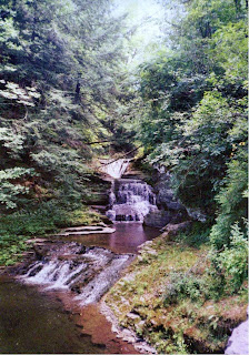
The upper parking area includes an old mill which has been converted into a display/educational center and incudes a cool look at how the mill worked. There's also a very nice waterfall behind the mill. From there we started our hike down the trail, which initially was nice but nothing spectacular. After a fairly short walk, however, we entered the actual gorge and were surrounded by cool rock formations and waterfalls.
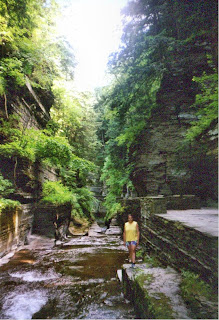
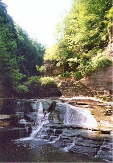
And a little bit further along - things really opened up!

One of the reasons I wanted to make sure we saw the upper gorge was Lucifer Falls, one of the tallest (115 feet) in the area. As we hiked down through the gorge (and the trail did indeed go up and down... but fortunately also included some level stretches!) we first viewed the top of the falls and then a while later the lower portions. Risking the potential wrath of any rangers, we walked up the creek toward the base of the falls. Very cool!

From there we continued on down the trail, probably for a total distance of 2 miles or so. This is a beautiful park, and the distance from the parking areas seemed to help cut down a bit on the number of folks on the trail... though we did pass quite a few other hikers going in both directions. We somewhat dreaded the hike back to the car, but it really wasn't that bad... the level stretches made it easier than Buttermilk Fall's non-stop climbing/descending, and we stopped at a lot of smaller waterfalls to take pictures.

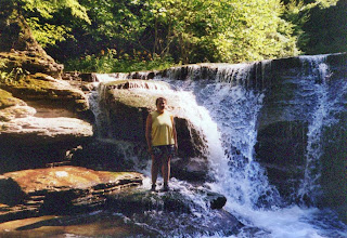

After we'd returned to the car, we drove down to the lower parking area and walked in to see the Lower Falls... another one which has been converted into a swimming area, to the great detriment of its scenic beauty. This area was also much more crowded, particularly because the park campgrounds are within easy walking distance. I'm very glad we didn't start from this end of the park - I don't know that we would have hiked all the way to the top, and it would have been a real shame to miss what I think were the best parts of the park!

So... don't know if I can really recommend hiking these parks after running a hilly 9 mile race in the morning (though I did survive and enjoyed myself! But I suspect my legs will be thrashed for several days...) But they are definitely beautiful places well worth visiting, and given that they're only 5 minutes apart, combining both parks into a single day's trip sure does make sense. (Taughannock Falls State Park and Fillmore Glen State Park are two others that are relatively close ie. within half an hour's drive - both also feature some great waterfalls and beautiful scenery. Ann and I visited Taughannock Falls last June, and I ran a race at Fillmore Glen last July.) If you do decide to visit several parks in one day, save your receipt from the first one - it's good for admission to any NYS park visited on that same day.
JMH
Hiking at Buttermilk Falls State Park & Robert Treman State Park
Sunday, July 15, 2007
Why are there so many gorges in the Finger Lakes region?
Buttermilk Falls State Park official site
Robert Treman State Park official site
Buttermilk Falls photo slideshow
Robert Treman State Park photo slideshow
Apparently "Ithaca is Gorges" is a popular slogan in the Ithaca area, in part because of the number of gorges and waterfalls in relatively close proximity to the city. Last year Ann and I visited Taughannock Falls State Park, just a little ways northwest of Ithaca, and I ran a race at the Filmore Glen State Park to the northeast. Since we were in the area anyways (and since Ann had spent a fairly boring 2 1/2 hours waiting for me to run the Forest Frolic 15k) we decided that after grabbing some lunch we'd do a little hiking at two of the local state parks, both with gorges and waterfalls. After all, what sensible person wouldn't want to spend the afternoon hiking up and down steep trails and stairways after spending two hours running up and down hilly trails in the morning?
Buttermilk Falls State Park


The weather didn't look too promising when we arrived at Buttermilk Falls, but it turned out to be a fairly nice afternoon (though a bit warm and humid.) We spotted the main waterfall immediately on driving into the park - shame they had to go and make the pool beneath the falls a swimming area, but I imagine that brings in a lot of revenue for the park and helps it stay open for people like Ann and me to hike the trails!


We chose to hike up and back on the gorge trail; the rim trail just didn't seem to offer much in the way of views of the stream and waterfalls. Hike "up" is a good description - between the lower parking area and the road at the top of the gorge, there were many, many, many steps and lots of hills, both gradual and steep, but very few level stretches of trail. The gorge was beautiful, with all sorts of cool rock formations and multiple waterfalls. At least that gave us plenty of excuses to stop and catch our breath...


We climbed out of the gorge and visited the upper parking area for a quick rest stop at the top, about 3/4 of a mile from where we started. Then it was time for the climb back down... my bad knees are not fond of downhills, and adding in my legs being somewhat thrashed from the race this morning meant it was very slow going. I was also very hot and a bit dehydrated... I enjoyed the trip back through the gorge (except for all the people who'd appeared, now that the weather was looking better) but was definitely tired and cranky by the time we reached the bottom. But the cool (well, not too warm) drinks waiting in the car helped revive me as we made the five minute drive to the 2nd leg of our Ithaca hiking adventure.

As a quick aside, I have since learned that the Finger Lakes Runners Club holds a 10k trail race at Buttermilk Falls in early June... unfortunately the same day as NIPMUCK. So next year that's not an option (I will be running NIPMUCK, the whole thing, next year!) but maybe in 2009...
Robert Treman State Park
This park left us in a bit of a quandary... the gorge trail is much longer than at Buttermilk (2 1/2 miles as opposed to 3/4 mile) and according to our guide book(Rich and Sue Freeman's 200 Waterfalls in Central and Western New York) involves a lot of climbing and descending all along its length. Given that we were both a bit tired from our earlier exertions, we weren't at all sure we'd be able to hike the entire distance. A bit more research showed that the most interesting features seemed to be closer to the top of the gorge, so in the end we drove to the upper parking area and hiked out of there (an excellent choice, as it turned out.)

The upper parking area includes an old mill which has been converted into a display/educational center and incudes a cool look at how the mill worked. There's also a very nice waterfall behind the mill. From there we started our hike down the trail, which initially was nice but nothing spectacular. After a fairly short walk, however, we entered the actual gorge and were surrounded by cool rock formations and waterfalls.


And a little bit further along - things really opened up!

One of the reasons I wanted to make sure we saw the upper gorge was Lucifer Falls, one of the tallest (115 feet) in the area. As we hiked down through the gorge (and the trail did indeed go up and down... but fortunately also included some level stretches!) we first viewed the top of the falls and then a while later the lower portions. Risking the potential wrath of any rangers, we walked up the creek toward the base of the falls. Very cool!

From there we continued on down the trail, probably for a total distance of 2 miles or so. This is a beautiful park, and the distance from the parking areas seemed to help cut down a bit on the number of folks on the trail... though we did pass quite a few other hikers going in both directions. We somewhat dreaded the hike back to the car, but it really wasn't that bad... the level stretches made it easier than Buttermilk Fall's non-stop climbing/descending, and we stopped at a lot of smaller waterfalls to take pictures.


After we'd returned to the car, we drove down to the lower parking area and walked in to see the Lower Falls... another one which has been converted into a swimming area, to the great detriment of its scenic beauty. This area was also much more crowded, particularly because the park campgrounds are within easy walking distance. I'm very glad we didn't start from this end of the park - I don't know that we would have hiked all the way to the top, and it would have been a real shame to miss what I think were the best parts of the park!
So... don't know if I can really recommend hiking these parks after running a hilly 9 mile race in the morning (though I did survive and enjoyed myself! But I suspect my legs will be thrashed for several days...) But they are definitely beautiful places well worth visiting, and given that they're only 5 minutes apart, combining both parks into a single day's trip sure does make sense. (Taughannock Falls State Park and Fillmore Glen State Park are two others that are relatively close ie. within half an hour's drive - both also feature some great waterfalls and beautiful scenery. Ann and I visited Taughannock Falls last June, and I ran a race at Fillmore Glen last July.) If you do decide to visit several parks in one day, save your receipt from the first one - it's good for admission to any NYS park visited on that same day.
JMH
LONG DISTANCE 2007, Race #13
Forest Frolic 15k Trail Race
Sunday, July 15, 2007
2007 Forest Frolic results
Forest Frolic info
Forest Frolic 15k Trail Race
Sunday, July 15, 2007
2007 Forest Frolic results
Forest Frolic info
Usually I would be running the Indian Ladder 15k trail run this weekend... since 1998, there have only been two years (well, three now) that I didn't run Indian Ladder. In many ways that race feels like an old friend. But a number of circumstances convinced me that this year Indian ladder just wasn't going to work... which is how I found myself in the James Kennedy State Forest northeast of Ithaca this morning, running a race I'd never run before.
After a bit of hassle getting to the race site (we originally missed one of the turns, because the road sign was no longer there) I checked in and geared up. Also picked up a Forest Frolic Trail Raptor T-shirt - a race T with a very nice photo of a red-tailed hawk on it. Spent the rest of the pre-race time looking around at all the unfamiliar faces (I've done enough races in Rochester and Albany/western MA that while I don't know most of the runners, I recognize many of them) and wondering if I should switch to a two-bottle carrier, since a number of folks were wearing Camelbaks. In the end I compromised by adding a bottle of Gatorade powder to my belt, figuring that I could always refill at one of the self-serve water stops and make some Gatorade to keep me going. That turned out to be a good plan...
A few minutes before race time, the RD had the usual pre-race things to say, mostly focused on the course. This race is a bit unusual in that the 15k (actually, 8.9 miles) has a loop which can be run in either direction... I decided ahead of time to go with the option that meant I could go straight when I ran through the spot where the 15k and 7k courses intersect. After having some fun with the frontrunners and a false start, he called "GO!" and off we went.
The first 3/4 of a mile were along the road we'd driven in on - a seasonal use dirt road that was fairly washed out along the downhill stretch we ran at first. I kept the pace relatively slow, not wanting to lose a knee early in the run. When we hit the point where the 2 courses diverged, I headed straight - straight up a doubletrack ATV trail, which I hiked at a fairly brisk pace for about 15 minutes before reaching a section that I could run comfortably. But even then, since we were heading for the summits of Virgil Mountain and the Greek Peak Ski area, there were frequent uphill stretches. Eventually, the course turned off doubletrack on to singletrack, and this is where I met the frontrunners coming from the opposite direction (apparently, the direction I chose is considered to be the harder path.)
After dodging faster runners on the singletrack, I came out on a long, hot uphill stretch along a powerline service road. Lots of folks passed me going the other way as I slogged up the hill. I was very pleased to finally turn off that into the woods again, on more singletrack. Dodged a few more folks coming from the other direction, and then I had the trail to myself for the rest of the race (literally - I didn't see another person until the last quarter of a mile to the finish!) I found this part much more runnable - some uphill, but mostly level and downhill, through the fern-blanketed woods and across streams and even a short stretch down a dirt road. It definitely felt good to be running instead of hiking uphill! Made it back to the start of the loop at 1 hr 15 min, and knew I wasn't likely to make my goal of finishing in under 2 hrs, unless the 2nd loop (the rest of the 7k course) was much easier than what I had just run...

Hit a tough stretch fairly quickly - dark (due to the cloudy sky and dense overgrowth) with lots of roots and some mud. Continued the general downward trend, which was a bit worrying, since I knew at some point the trail would have to go back up! Made it down to the stream, ran along the bank for a while, and then finally crossed the stream and after a bit - hit the uphill. The first stretch seemed to go on and on - I ran for a bit and walked a lot. After that the trail alternated between relatively level (actually, probably gently uphill) and climbing. At one point I thought I heard voices, but never actually saw any other runners (though, looking at the results, there were a couple not that far ahead of me.) This part seemed to go on forever - at one point I began wondering if it was ever going to end, since I had no idea how far I'd come, only how much time I'd spent on the course.

Finally, a few minutes after the 2 hour mark, I came out on the road where we'd parked and ran the 0.4 miles down it to the finish, with a brief detour to the car to drop off my belt and water bottle. Crossed the finish in 2 hr 9 minutes, and then staggered around looking for food, drink, and dry clothes...
Overall, this was a fun run, albeit a slow one - 2:09 is not a very good time for 8.9 miles! On the other hand, it's close to my goal of 2 hours or less, and truth be told, I took it fairly easy on this one, both because I didn't know the course at all and didn't want to blow up before the end, and because I wanted to have a little energy left for hiking in the afternoon. I suspect I see why the direction I chose for the first loop is considered the "harder" one - most folks probably find they can make good time on the relatively wide downhill stretches I hiked up. I think it was actually easier for me to hike those parts and run the more varied singletrack back down, but maybe someday I'll do this one again and try the other direction to find out for sure...
Don't know that I'd want to make this a regular replacement for Indian Ladder - if nothing else, it's considerably more inconvenient to get to! But I think I would like to run it again... perhaps I can alternate between the two races and start a new tradition for this weekend...
Next up: another race with the Finger Lakes Road Runners, the Forge the Gorgeous 8 mile trail race at beautiful Filmore Glen State Park!
JMH
2007 EVENT TOTALS
Running 139.3 mi, 33 hr 24 min
Cycling 26.2 mi, 1 hr 55 min
Snowshoe 31.3 mi, 9 hr 11 min
states visited: CT, MA, ME, NH, NY, VT
Subscribe to:
Posts (Atom)


